File:2015 Manatuto beschriftet.png

Size of this preview: 456 × 599 pixels. Other resolutions: 183 × 240 pixels | 365 × 480 pixels | 585 × 768 pixels | 780 × 1,024 pixels | 1,560 × 2,048 pixels | 3,061 × 4,019 pixels.
Original file (3,061 × 4,019 pixels, file size: 1.23 MB, MIME type: image/png)
| This is a file from the Wikimedia Commons. Information from its description page there is shown below. Commons is a freely licensed media file repository. You can help. |
Summary
| Description |
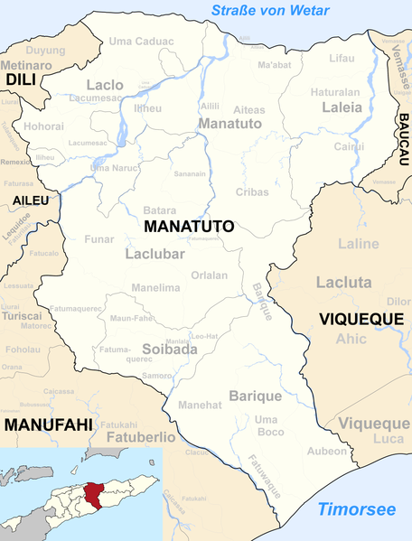
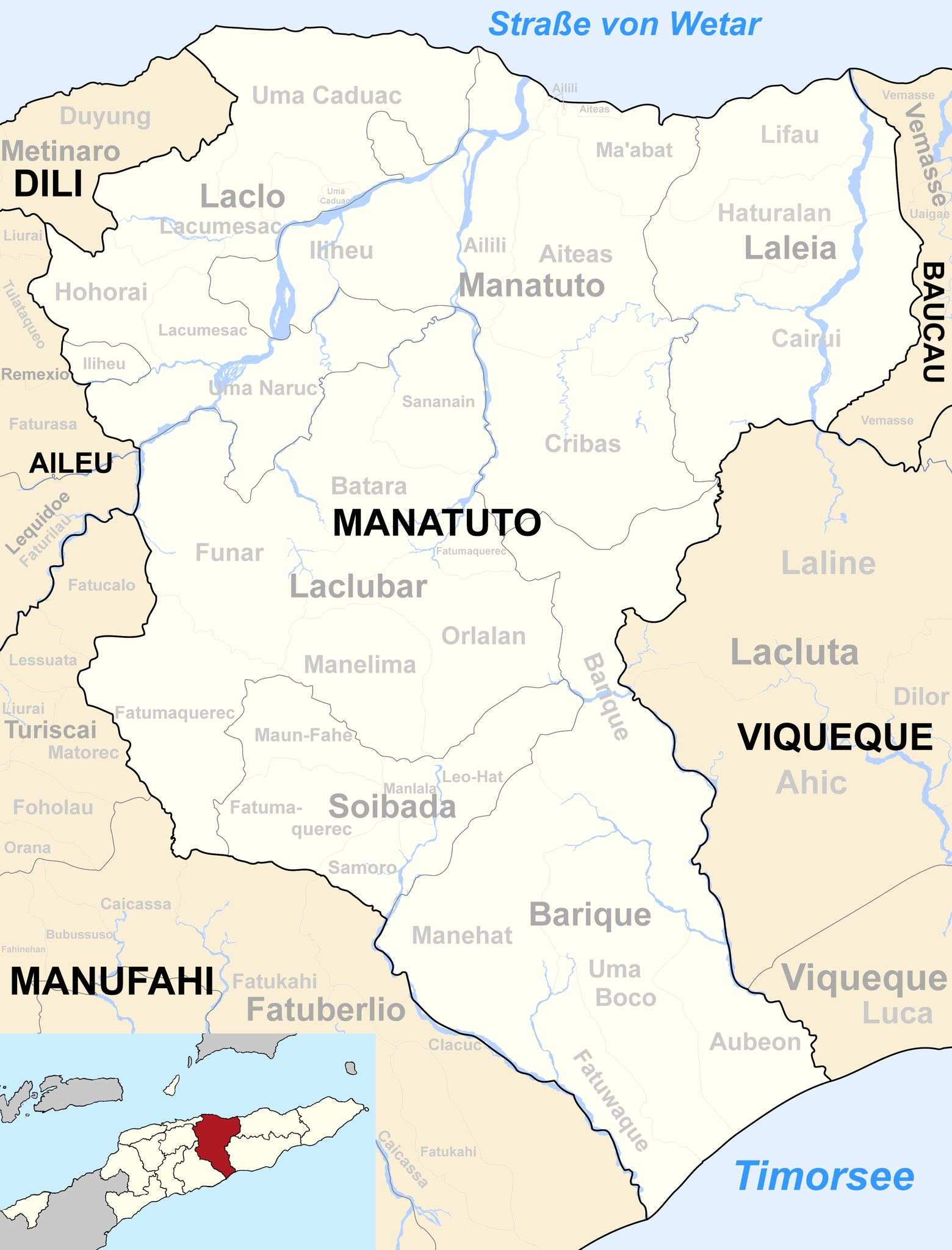
Deutsch: Verwaltungseinheiten der Gemeinde Manatuto, Osttimor. |
| Date | |
| Source | Informationen von Ministerium für Staatsadministration, Osttimor |
| Author | Von mir (J. Patrick Fischer) überarbeitetes Werk: File:Map of Timor-Leste - administrative (since 2015) - Município of Manatuto.png von Maximilian Dörrbecker (Chumwa) und File:2015 East Timor Manatuto locator map.png von mir |
| Other versions | Vor 2015: File:Sucos Manatuto.png |
_-_Munic%C3%ADpio_of_Manatuto.png)
Licensing
I, the copyright holder of this work, hereby publish it under the following license:
This file is licensed under the Creative Commons Attribution-Share Alike 2.5 Generic license.
- You are free:
- to share – to copy, distribute and transmit the work
- to remix – to adapt the work
- Under the following conditions:
- attribution – You must give appropriate credit, provide a link to the license, and indicate if changes were made. You may do so in any reasonable manner, but not in any way that suggests the licensor endorses you or your use.
- share alike – If you remix, transform, or build upon the material, you must distribute your contributions under the same or compatible license as the original.
File history
Click on a date/time to view the file as it appeared at that time.
| Date/Time | Thumbnail | Dimensions | User | Comment | |
|---|---|---|---|---|---|
| current | 17:12, 11 July 2020 | | 3,061 × 4,019 (1.23 MB) | J. Patrick Fischer | Fehler in der Beschriftung |
| 13:50, 6 January 2018 |  | 3,061 × 4,019 (1.23 MB) | J. Patrick Fischer | == {{int:filedesc}} == {{Information |Description ={{de|1=Verwaltungseinheiten der Gemeinde Manatuto, Osttimor.}} |Source = Informationen von [http://www.estatal.gov.tl/pt/municipio-de-manatuto/ Ministerium für Staatsadministration, Osttimo... |
File usage
The following page uses this file:
Global file usage
The following other wikis use this file:
- Usage on ce.wikipedia.org
- Usage on de.wikipedia.org
- Usage on fr.wikipedia.org
- Usage on hy.wikipedia.org
- Usage on id.wikipedia.org
- Usage on it.wikipedia.org
- Usage on ja.wikipedia.org
- Usage on ko.wikipedia.org
- Usage on ms.wikipedia.org
- Usage on pl.wikipedia.org
- Usage on pt.wikipedia.org
- Usage on ro.wikipedia.org
- Usage on ru.wikipedia.org
- Usage on tet.wikipedia.org
- Manatutu (munisípiu)
- Lista administrativu Timor-Leste nian
- Barike (postu administrativu)
- Lakló (postu administrativu)
- Barike
- Manatutu (postu administrativu)
- Laklubar (postu administrativu)
- Soibada (postu administrativu)
- Laleia (postu administrativu)
- Aubeon
- Fatuwake
- Manehat
- Umaboku
- Hohorai
- Laku Mesak
- Umakaduak
- Umanaruk
- Batara
- Fatumakerek (Laklubar)
- Funar
- Manelima
- Orlalan
- Sananain
- Haturalan
- Kairui
- Lifau (Laleia)
- Ailili
- Aiteas
- Iliheu
- Kribas
- Maabat
View more global usage of this file.