Larimer County, Colorado
county in Colorado, United States
Larimer County is one of the 64 counties in the U.S. state of Colorado. As of the 2020 census, the population was 359,066.[1] The county seat and most populous city is Fort Collins.[2] The county was named for William Larimer, Jr.,[3] the founder of Denver.
Larimer County | |
|---|---|
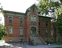
 Colorado State University Spruce Hall. | |
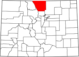
 Location within the U.S. state of Colorado | |
 Colorado's location within the U.S. | |
| Coordinates: 40°39′N 105°28′W / 40.65°N 105.46°W | |
| Country | |
| State | |
| Founded | November 1, 1861 |
| Named for | William Larimer, Jr. |
| Seat | Fort Collins |
| Largest city | Fort Collins |
| Area | |
| • Total | 2,634 sq mi (6,820 km2) |
| • Land | 2,596 sq mi (6,720 km2) |
| • Water | 38 sq mi (100 km2) 1.4% |
| Population | |
| • Total | 359,066 |
| • Density | 138/sq mi (53/km2) |
| Time zone | UTC−7 (Mountain) |
| • Summer (DST) | UTC−6 (MDT) |
| Website | www |
Larimer County was founded in 1861.
Geography change
The county has a total area of 2,634 square miles (6,820 km2). It is at the northern end of the Front Range, at the edge of the Colorado Eastern Plains along the border with Wyoming.
Bordering counties change
- Laramie County, Wyoming - northeast
- Weld County - east
- Boulder County - south
- Grand County - southwest
- Jackson County - west
- Albany County, Wyoming - northwest
Communities change
Cities change
Towns change
- Berthoud
- Estes Park
- Johnstown (partially in Larimer and partially in Weld county)
- Timnath
- Wellington
- Windsor (partially in Larimer and partially in Weld County)
Census-designated places change
Unincorporated communities change
Ghost towns change
- Manhattan
- Old Roach
- Virginia Dale
References change
- ↑ 1.0 1.1 "QuickFacts: Larimer County, Colorado". United States Census Bureau. Retrieved August 8, 2023.
- ↑ "Find a County". National Association of Counties. Retrieved 2011-06-07.
- ↑ Gannett, Henry (1905). The Origin of Certain Place Names in the United States. U.S. Government Printing Office. p. 181.
Other websites change
Wikimedia Commons has media related to Larimer County, Colorado.