Twin Falls, Idaho
Twin Falls is a city in Idaho in the United States. It is the county seat of Twin Falls County, Idaho. The 2020 population was 51,807.[3]
Twin Falls, Idaho | |
|---|---|
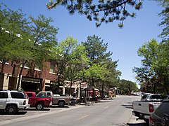
 Downtown Twin Falls in 2016 | |
| Motto: People Serving People | |
 Location of Twin Falls in Twin Falls County, Idaho. | |
| Coordinates: 42°33′20″N 114°28′15″W / 42.55556°N 114.47083°W | |
| Country | United States |
| State | Idaho |
| County | Twin Falls |
| Incorporated | April 12, 1905 |
| Government | |
| • Type | Council-manager |
| Area | |
| • City | 19.47 sq mi (50.43 km2) |
| • Land | 19.36 sq mi (50.13 km2) |
| • Water | 0.11 sq mi (0.30 km2) |
| Elevation | 3,734 ft (1,138 m) |
| Population | |
| • City | 51,807 |
| • Density | 2,676.7/sq mi (1,033.5/km2) |
| • Metro | 114,283 |
| Time zone | UTC-7 (MST) |
| • Summer (DST) | UTC-6 (MDT) |
| ZIP Code | 83301 (street addresses) 83303 (PO Boxes) |
| Area code(s) | 208, 986 |
| FIPS code | 16-82810 |
| GNIS feature ID | 0398273[2] |
| Interstate | |
| U.S. Route(s) | |
| Website | http://www.tfid.org |
History change
In 1900, I. B. Perrine founded the Twin Falls Land and Water Company to build an irrigation canal in the area now known as Twin Falls.[5] One of the investors was named Stanley Milner. By 1903, Perrine and his investors had government approval to build a dam on the Snake River. The dam was finished in 1905. It is now called Milner Dam. It allows farmers in the area to irrigate their crops.
In 1904, some property in the area was sold off to start a few towns. One of those towns was Twin Falls.[5] The others include Buhl, Filer, Hansen, Kimberly, and Murtaugh. Many of those towns were named for the original investors in the Twin Falls land and Water Company.
Twin Falls was incorporated on April 12, 1905[6] as a village.
On February 21, 1907, Twin Falls became the county seat of the new Twin Falls County.[7] Prior to that, the city was part of Cassia County.
On September 8, 1974, Evel Knievel attempted to jump the Snake River Canyon on a rocket cycle at a site close to Twin Falls. The attempt failed.[8] Located on private property at 42°35′49″N 114°25′23″W / 42.597°N 114.423°W, the ramp's base remains in place as of January, 2016. Evel Knievel was paid six million dollars (US) for trying to jump the canyon. The payment was promised no matter the outcome of the attempt.
Government change
Twin Falls has a council-manager form of government. The city council hires a manager to supervise city employees on a day-to-day basis, and the position of "mayor" is appointed by the city council from among their own members.
References change
- ↑ "2020 U.S. Gazetteer Files". United States Census Bureau. Retrieved September 19, 2023.
- ↑ 2.0 2.1 U.S. Geological Survey Geographic Names Information System: Twin Falls, Idaho
- ↑ 3.0 3.1 "Twin Falls city, Idaho". United States Census Bureau. Retrieved September 19, 2023.
- ↑ "Population and Housing Unit Estimates". United States Census Bureau. May 24, 2020. Retrieved May 27, 2020.
- ↑ 5.0 5.1 Smith, Paul. "The History of Twin Falls". Twin Falls (Idaho) official website. Archived from the original on 22 February 2014. Retrieved 23 January 2016.
- ↑ "Welcome to Twin Falls County, Idaho". Retrieved 23 January 2016.
- ↑ "Twin Falls". Official website of the State of Idaho. State of Idaho. Archived from the original on 17 March 2016. Retrieved 23 January 2016.
- ↑ Miller, Hack (September 9, 1974). "Evel Puzzle: What Popped Chute?". Deseret News. Retrieved 23 January 2016.
