Esch-sur-Alzette
Esch-sur-Alzette (Luxembourgish: Esch-Uelzecht pronounced [ˌæʒ ˈuəltsəɕt] (![]() listen), German: Esch an der Alzette [ˌɛʃ ʔan deːɐ̯ ʔalˈzɛt] or Esch an der Alzig, French: Esch-sur-Alzette) is a commune with city status in south-western Luxembourg, capital of the canton Esch-sur-Alzette.
listen), German: Esch an der Alzette [ˌɛʃ ʔan deːɐ̯ ʔalˈzɛt] or Esch an der Alzig, French: Esch-sur-Alzette) is a commune with city status in south-western Luxembourg, capital of the canton Esch-sur-Alzette.
Esch-sur-Alzette
Esch-Uelzecht | |
|---|---|
 The town seen from the Gaalgebierg park | |
 Coat of arms | |
 Map of Luxembourg with Esch-sur-Alzette highlighted in orange, and the canton in dark red | |
| Coordinates: 49°29′49″N 5°58′50″E / 49.4969°N 5.9806°E | |
| Country | |
| Canton | Esch-sur-Alzette |
| Government | |
| • Mayor | Mischo Georges (CSV) |
| Area | |
| • Total | 14.35 km2 (5.54 sq mi) |
| • Rank | 81st of 102 |
| Highest elevation | 426 m (1,398 ft) |
| • Rank | 32nd of 102 |
| Lowest elevation | 279 m (915 ft) |
| • Rank | 84th of 102 |
| Population (2020) | |
| • Total | 36,218 |
| • Rank | 2nd of 102 |
| • Density | 2,500/km2 (6,500/sq mi) |
| • Rank | 63rd of 102 |
| Time zone | UTC+1 (CET) |
| • Summer (DST) | UTC+2 (CEST) |
| LAU 2 | LU0000204 |
| Website | esch.lu |
The town is usually referred to just as Esch, but there is also a village and commune further north, in the Wiltz canton, named Esch-sur-Sûre from which to distinguish it.
History change
For a long time Esch-sur-Alzette was a small farming village in the valley of the Alzette river. This changed when important amounts of iron ore were found in the area in the 1850s. With the development of the mines and the steel industry the town's population multiplied tenfold in a couple of decades.
On 29 May 1906, Esch-sur-Alzette was promoted to city.[1]
Geography change
Esch-sur-Alzette is in the south-west of the country, on the border with France. It is the capital of the Red Lands region.
The commune is in the valley of the Alzette river, a right tributary of the Sauer river and which flows through the town, and has an area of 14.4 km2 (5.6 sq mi).[2] The altitude is 279–426 m (915–1,398 ft) high. At the city hall, the altitude is 287 m (942 ft) high.[3]
Esch-sur-Alzette is surrounded by six communes of Luxembourg: Mondercange to the north, Schifflange to the northeast, Kayl to the east, Rumelange to the southeast and Sanem to the northwest. To the southwest, the commune borders the Audun-le-Tiche commune in the Moselle department of France; and to the west Russange also in the Moselle department.
Population change
There were 34,378 persons living in the commune in 2017,[4] for a population density of 2,387.4 inhabitants/km².
Evolution of the population in Esch-sur-Alzette

Twinned and partner towns change
Gallery change

-
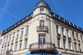 Building in Esch-sur-Alzette
 -
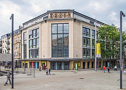 Théâtre d’Esch
 -
 Synagogue of Esch-sur-Alzette
 -
 Saint Joseph Couch


.jpg)
Related pages change
References change
- ↑ "Mémorial A, 1906, No. 34" (PDF). Service central de législation. Retrieved 1 June 2016.[permanent dead link](in French and German)
- ↑ "Surface area of the cantons and municipalities". Statistics Portal - Grand Duchy of Luxembourg. Retrieved 27 May 2016.
- ↑ "Altitudes of the different localities per cantons (in m)". Statistics Portal - Grand Duchy of Luxembourg. Retrieved 10 June 2016.
- ↑ "Population by canton and municipality 1821 - 2017". Statistics Portal - Grand Duchy of Luxembourg. Retrieved 30 December 2017.
- ↑ "Le jumelage, un partenariat stratégique entre villes" (in French). La Ville de Esch-sur-Alzette. Archived from the original on 9 January 2015. Retrieved 1 June 2016.
Other websites change
- Official website (in French)