File:A map of Canaan (8343807206).jpg

Size of this preview: 735 × 599 pixels. Other resolutions: 294 × 240 pixels | 589 × 480 pixels | 942 × 768 pixels | 1,256 × 1,024 pixels | 2,511 × 2,048 pixels | 7,062 × 5,759 pixels.
Original file (7,062 × 5,759 pixels, file size: 38.43 MB, MIME type: image/jpeg)
| This is a file from the Wikimedia Commons. Information from its description page there is shown below. Commons is a freely licensed media file repository. You can help. |
Summary
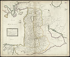
| Description |
Zoom into this map at maps.bpl.org. Author: Lea, Philip Publisher: Lea, Philip Date: 1692 Location: Holy Land, Israel, Palestine Dimensions: 51 x 60 cm. Scale: Scale not given Call Number: G1015 .C65 1630 |
| Date | |
| Source | A map of Canaan |
| Author | http://maps.bpl.org |
| Other versions |
_(cropped).jpg)
.jpg)
Licensing
This file is licensed under the Creative Commons Attribution 2.0 Generic license.
- You are free:
- to share – to copy, distribute and transmit the work
- to remix – to adapt the work
- Under the following conditions:
- attribution – You must give appropriate credit, provide a link to the license, and indicate if changes were made. You may do so in any reasonable manner, but not in any way that suggests the licensor endorses you or your use.
| This image, originally posted to Flickr, was reviewed on 21 August 2013 by the administrator or reviewer File Upload Bot (Magnus Manske), who confirmed that it was available on Flickr under the stated license on that date. |
File history
Click on a date/time to view the file as it appeared at that time.
| Date/Time | Thumbnail | Dimensions | User | Comment | |
|---|---|---|---|---|---|
| current | 00:56, 30 October 2016 | | 7,062 × 5,759 (38.43 MB) | Opencooper | full resolution |
| 03:50, 21 August 2013 |  | 800 × 652 (128 KB) | File Upload Bot (Magnus Manske) | Transferred from Flickr by User:tm |
File usage
The following page uses this file:
Global file usage
The following other wikis use this file:
- Usage on ast.wikipedia.org
- Usage on azb.wikipedia.org
- Usage on bn.wikipedia.org
- Usage on ca.wikipedia.org
- Usage on diq.wikipedia.org
- Usage on en.wikipedia.org
- Usage on eo.wikipedia.org
- Usage on es.wikipedia.org
- Usage on et.wikipedia.org
- Usage on eu.wikipedia.org
- Usage on gl.wikipedia.org
- Usage on id.wikipedia.org
- Usage on it.wikipedia.org
- Usage on ka.wikipedia.org
- Usage on ku.wikipedia.org
- Usage on mnw.wikipedia.org
- Usage on pa.wikipedia.org
- Usage on ru.wikipedia.org
- Usage on sd.wikipedia.org
- Usage on sr.wikipedia.org
- Usage on sv.wikipedia.org
- Usage on ta.wikipedia.org
- Usage on tr.wikipedia.org
- Usage on vi.wikipedia.org
- Usage on war.wikipedia.org
- Usage on www.wikidata.org
.jpg)