File:Albania District.svg

Size of this PNG preview of this SVG file: 304 × 600 pixels. Other resolutions: 121 × 240 pixels | 243 × 480 pixels | 389 × 768 pixels | 519 × 1,024 pixels | 1,038 × 2,048 pixels | 508 × 1,002 pixels.
Original file (SVG file, nominally 508 × 1,002 pixels, file size: 276 KB)
| This is a file from the Wikimedia Commons. Information from its description page there is shown below. Commons is a freely licensed media file repository. You can help. |
| Description |
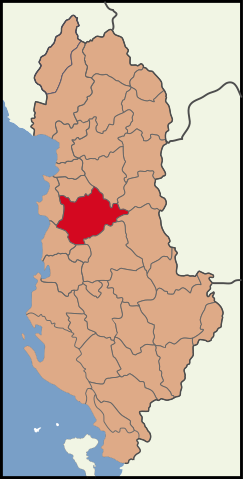
English: Albania location Tirana County.
Blank map of the districts of Albania, useful for numbering/labelling for other languages. |
||
| Date | (UTC) | ||
| Source | |||
| Author |
|
||
| SVG development | This W3C-invalid map was created with Adobe Illustrator.
|
This file is licensed under the Creative Commons Attribution-Share Alike 3.0 Unported license.
- You are free:
- to share – to copy, distribute and transmit the work
- to remix – to adapt the work
- Under the following conditions:
- attribution – You must give appropriate credit, provide a link to the license, and indicate if changes were made. You may do so in any reasonable manner, but not in any way that suggests the licensor endorses you or your use.
- share alike – If you remix, transform, or build upon the material, you must distribute your contributions under the same or compatible license as the original.
Original upload log
This image is a derivative work of the following images:
- File:Albania location Tirana.svg licensed with Cc-by-3.0
- 2010-03-30T16:55:33Z The Emirr 508x1002 (201332 Bytes) {{Information |Description={{en|1=Albania location Tirana County.}} |Source={{own}} |Author={{click|image=TheEmirr-Logo.png|link=User:The Emirr|width=60px|height=60px}} |Date=2010-03-30 |Permission={{The Emirr}} |other_versio
- File:Albania districts.svg licensed with Cc-by-2.5, Cc-by-sa-3.0-migrated, GFDL
- 2011-05-07T19:36:03Z Malyszkz 1000x2112 (113600 Bytes) change border size
- 2011-05-07T18:46:45Z Malyszkz 1000x2112 (113609 Bytes) {{Information |Description=Blank map of the districts of Albania, useful for numbering/labelling for other languages. |Source=*[[:File:Albania_districts_blank_2.svg|]] |Date=2011-05-07 18:46 (UTC) |Author=*[[:File:Albania_dis
Uploaded with derivativeFX
File history
Click on a date/time to view the file as it appeared at that time.
| Date/Time | Thumbnail | Dimensions | User | Comment | |
|---|---|---|---|---|---|
| current | 12:18, 8 May 2011 | | 508 × 1,002 (276 KB) | Vinie007 | color fix |
| 12:00, 8 May 2011 |  | 508 × 1,002 (276 KB) | Malyszkz | {{Information |Description={{en|1=Albania location Tirana County.}} Blank map of the districts of Albania, useful for numbering/labelling for other languages. |Source=*File:Albania_location_Tirana.svg *File:Albania_districts.svg |Date=2011-05- |
File usage
The following page uses this file:
Global file usage
The following other wikis use this file:
- Usage on dv.wikipedia.org
- Usage on en.wikipedia.org
- Usage on fa.wikipedia.org
- Usage on incubator.wikimedia.org
- Usage on lt.wikipedia.org
- Usage on nap.wikipedia.org
- Usage on pa.wikipedia.org
- Usage on pnt.wikipedia.org
- Usage on rm.wikipedia.org
- Usage on ru.wikipedia.org
- Usage on sco.wikipedia.org
- Usage on sq.wikipedia.org
- Usage on sr.wikipedia.org
- Usage on ti.wikipedia.org
- Usage on vi.wikipedia.org