File:Altstadt Koblenz.jpg
Size of this preview: 800 × 600 pixels. Other resolutions: 320 × 240 pixels | 640 × 480 pixels | 1,024 × 768 pixels | 1,280 × 960 pixels | 2,000 × 1,500 pixels.
Original file (2,000 × 1,500 pixels, file size: 697 KB, MIME type: image/jpeg)
| This is a file from the Wikimedia Commons. Information from its description page there is shown below. Commons is a freely licensed media file repository. You can help. |
Summary
| Description |
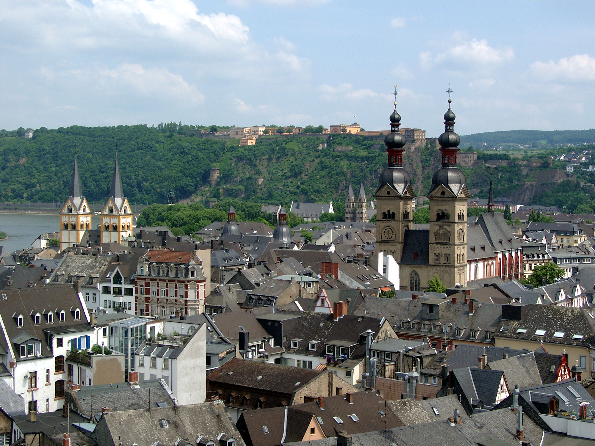
Deutsch: Altstadt von Koblenz, links die Florinskirche, rechts die Liebfrauenkirche, im Hintergrund die Kastorkirche und die Festung Ehrenbreitstein
English: Old town of Koblenz, left Florinskirche, right Liebfrauenkirche, in the background Kastorkirche and Festung Ehrenbreitstein
Français : Coblence centre ville, église Saint-Florin, église Notre-Dame, Basilique Saint-Castor et Forteresse d'Ehrenbreitstein |
| Date | Taken on 28 May 2003 |
| Source | originally uploaded to DE by author, self-made by author |
| Author | Holger Weinandt |
| Permission (Reusing this file) |
GFDL |
| Camera location | | View this and other nearby images on: OpenStreetMap |
|---|

|
Permission is granted to copy, distribute and/or modify this document under the terms of the GNU Free Documentation License, Version 1.2 or any later version published by the Free Software Foundation; with no Invariant Sections, no Front-Cover Texts, and no Back-Cover Texts. A copy of the license is included in the section entitled GNU Free Documentation License. |
| This file is licensed under the Creative Commons Attribution-Share Alike 3.0 Unported license. | ||
| ||
| This licensing tag was added to this file as part of the GFDL licensing update. |
File history
Click on a date/time to view the file as it appeared at that time.
| Date/Time | Thumbnail | Dimensions | User | Comment | |
|---|---|---|---|---|---|
| current | 09:05, 18 May 2009 | | 2,000 × 1,500 (697 KB) | Schaengel | Höhere Auflösung |
| 09:39, 18 August 2005 |  | 1,024 × 768 (528 KB) | Schaengel89~commonswiki | {{Information| |Description =Old town of Koblenz; left Florinskirche, right Florinskirche, in background Festung Ehrenbreitstein |Source =originally uploaded to DE by author, self-made by author |Date =28. Apr 2003 |Author =Holger Weinand |
File usage
There are no pages that use this file.
Global file usage
The following other wikis use this file:
- Usage on af.wikipedia.org
- Usage on als.wikipedia.org
- Usage on ar.wikipedia.org
- Usage on br.wikipedia.org
- Usage on cs.wikipedia.org
- Usage on cy.wikipedia.org
- Usage on de.wikipedia.org
- Usage on en.wikipedia.org
- Usage on et.wikipedia.org
- Usage on eu.wikipedia.org
- Usage on fa.wikipedia.org
- Usage on fi.wikipedia.org
- Usage on fr.wikipedia.org
- Usage on fy.wikipedia.org
- Usage on ha.wikipedia.org
- Usage on hr.wikipedia.org
- Usage on ie.wikipedia.org
- Usage on is.wikipedia.org
- Usage on it.wikipedia.org
- Usage on it.wikivoyage.org
- Usage on ko.wikipedia.org
- Usage on lt.wikipedia.org
- Usage on lv.wikipedia.org
- Usage on ms.wikipedia.org
- Usage on nl.wikipedia.org
- Usage on pnb.wikipedia.org
- Usage on ru.wikivoyage.org
- Usage on sco.wikipedia.org
- Usage on sh.wikipedia.org
- Usage on sk.wikipedia.org
- Usage on sr.wikipedia.org
- Usage on stq.wikipedia.org
- Usage on sw.wikipedia.org
- Usage on vi.wikipedia.org