File:Arran satellite.jpg
Size of this preview: 396 × 599 pixels. Other resolutions: 158 × 240 pixels | 317 × 480 pixels | 752 × 1,138 pixels.
Original file (752 × 1,138 pixels, file size: 144 KB, MIME type: image/jpeg)
| This is a file from the Wikimedia Commons. Information from its description page there is shown below. Commons is a freely licensed media file repository. You can help. |
Summary
| Description |
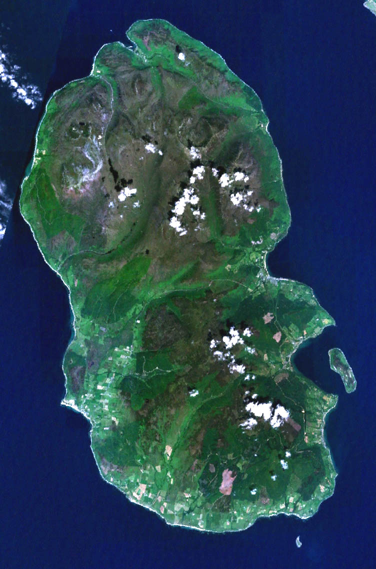
English: Landsat image of the Isle of Arran in Scotland. |
||
| Date | 4 July 2005 (original upload date) | ||
| Source |
NASA Landsat image. Made with World Wind. |
||
| Author | NASA | ||
| Other versions |
|

Licensing
| This image is in the public domain because it is a screenshot from NASA’s globe software World Wind using a public domain layer, such as Blue Marble, MODIS, Landsat, SRTM, USGS or GLOBE.
|
 |
File history
Click on a date/time to view the file as it appeared at that time.
| Date/Time | Thumbnail | Dimensions | User | Comment | |
|---|---|---|---|---|---|
| current | 05:45, 11 May 2006 | | 752 × 1,138 (144 KB) | 汲平 | This came from en:Image:Arran satellite.jpg posted by en:User:Finlay McWalter on July 4, 2005 under PD-USGov-NASA. The original page says "NASA Landsat image of the Isle of Arran in Scotland. Made with World Wind." |
File usage
The following page uses this file:
Global file usage
The following other wikis use this file:
- Usage on ar.wikipedia.org
- Usage on az.wikipedia.org
- Usage on be.wikipedia.org
- Usage on br.wikipedia.org
- Usage on de.wikipedia.org
- Usage on el.wikipedia.org
- Usage on en.wikipedia.org
- Brodick
- Lamlash
- Arran distillery
- Blackwaterfoot
- Lochranza
- Whiting Bay
- Holy Island, Firth of Clyde
- Goat Fell
- Brodick Castle
- Pladda
- Lochranza Castle
- Catacol
- Caisteal Abhail
- Corrie, Arran
- Kilmory, Arran
- Tighvein
- Sliddery
- Shiskine
- Kildonan, Arran
- Pirnmill
- Sannox
- Cladach
- Beinn Tarsuinn (Corbett)
- Sleeping Warrior
- Lagg, Arran
- Cìr Mhòr
- Dippen, Arran
- Creag Ghlas Laggan
- Machrie
- Whitefarland
- List of places in North Ayrshire
- Isle of Arran
- The Arran Banner
- Template:Isle of Arran
- Eas a' Chrannaig
- Beinn Bharrain
- Usage on es.wikipedia.org
- Usage on fr.wikipedia.org
View more global usage of this file.