File:Avesta från ovan.jpg
Size of this preview: 800 × 436 pixels. Other resolutions: 320 × 175 pixels | 640 × 349 pixels | 1,024 × 559 pixels | 1,280 × 698 pixels | 2,560 × 1,396 pixels | 4,231 × 2,308 pixels.
Original file (4,231 × 2,308 pixels, file size: 2.44 MB, MIME type: image/jpeg)
| This is a file from the Wikimedia Commons. Information from its description page there is shown below. Commons is a freely licensed media file repository. You can help. |
Summary
| Description |
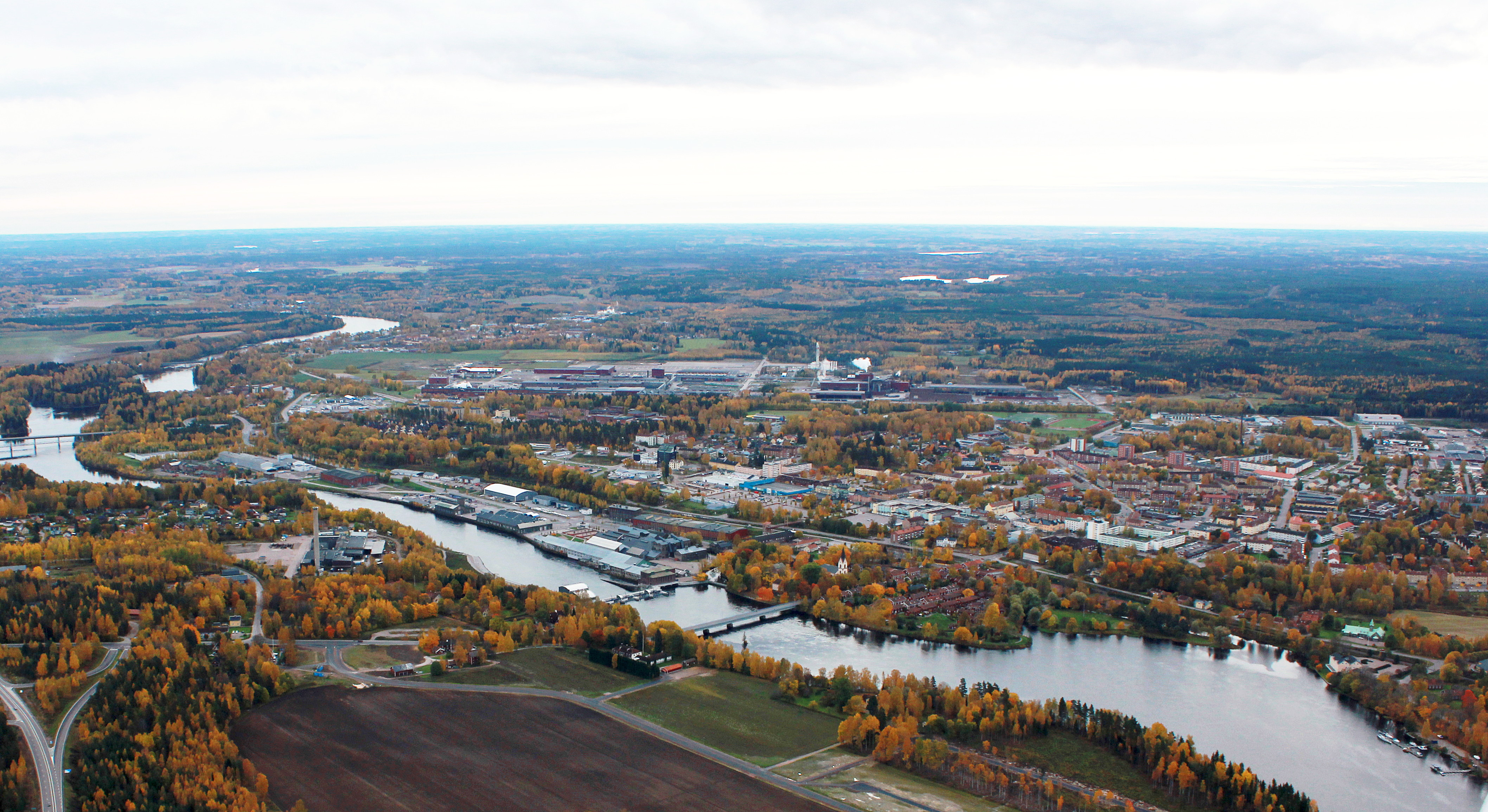
Svenska: Avesta, från Högbo och Månsbo t.v. till Prästjorden t.h, med Dalälven tvärs igenom. Riksväg 70 i nedre vänstra hörnet. |
| Date | |
| Source | Own work |
| Author | Calle Eklund/V-wolf |
| Camera location | | View this and other nearby images on: OpenStreetMap |
|---|
| This aerial photograph has been approved for publishing by the Swedish Armed Forces with the ID: FMTM 10 830:11043
|
Licensing
I, the copyright holder of this work, hereby publish it under the following licenses:

|
Permission is granted to copy, distribute and/or modify this document under the terms of the GNU Free Documentation License, Version 1.2 or any later version published by the Free Software Foundation; with no Invariant Sections, no Front-Cover Texts, and no Back-Cover Texts. A copy of the license is included in the section entitled GNU Free Documentation License. |
This file is licensed under the Creative Commons Attribution-Share Alike 3.0 Unported license.
- You are free:
- to share – to copy, distribute and transmit the work
- to remix – to adapt the work
- Under the following conditions:
- attribution – You must give appropriate credit, provide a link to the license, and indicate if changes were made. You may do so in any reasonable manner, but not in any way that suggests the licensor endorses you or your use.
- share alike – If you remix, transform, or build upon the material, you must distribute your contributions under the same or compatible license as the original.
You may select the license of your choice.
| Annotations | This image is annotated: View the annotations at Commons |
File history
Click on a date/time to view the file as it appeared at that time.
| Date/Time | Thumbnail | Dimensions | User | Comment | |
|---|---|---|---|---|---|
| current | 09:31, 25 August 2016 | | 4,231 × 2,308 (2.44 MB) | Holger.Ellgaard | light |
| 20:25, 24 April 2012 |  | 4,231 × 2,308 (7.85 MB) | V-wolf | {{Information |Description ={{sv|1=Avesta, från Högbo och Månsbo t.v. till Prästjorden t.h, med Dalälven tvärs igenom. Riksväg 70 i nedre vänstra hörnet.}} |Source ... |
File usage
The following page uses this file:
Global file usage
The following other wikis use this file:
- Usage on bg.wikipedia.org
- Usage on ceb.wikipedia.org
- Usage on de.wikipedia.org
- Usage on el.wikipedia.org
- Usage on en.wikipedia.org
- Usage on fa.wikipedia.org
- Usage on fi.wikipedia.org
- Usage on fr.wikipedia.org
- Usage on it.wikipedia.org
- Usage on la.wikipedia.org
- Usage on ru.wikipedia.org
- Usage on sh.wikipedia.org
- Usage on sr.wikipedia.org
- Usage on sv.wikipedia.org
- Usage on tr.wikipedia.org
- Usage on zh-min-nan.wikipedia.org
- Usage on zh.wikipedia.org