File:Boso Peninsula Chiba Japan SRTM.jpg
Size of this preview: 665 × 599 pixels. Other resolutions: 266 × 240 pixels | 533 × 480 pixels | 929 × 837 pixels.
Original file (929 × 837 pixels, file size: 150 KB, MIME type: image/jpeg)
| This is a file from the Wikimedia Commons. Information from its description page there is shown below. Commons is a freely licensed media file repository. You can help. |
Summary
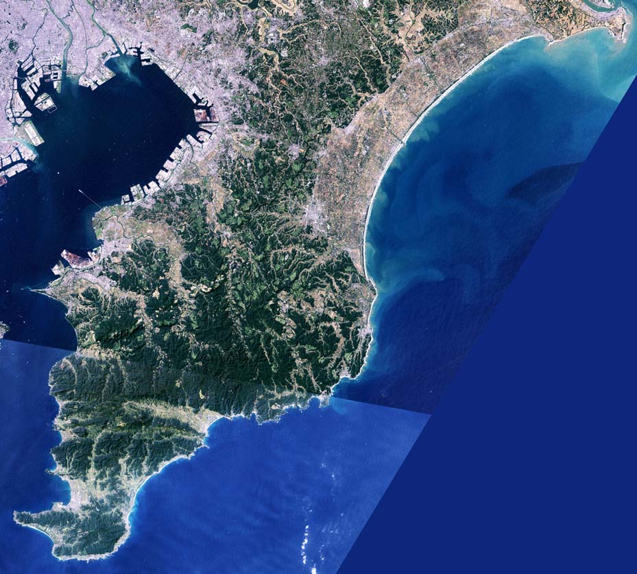
| Description | Boso Peninsula in Chiba Prefecture, Japan. |
| Date | |
| Source | image with high-resolution data from Space Shuttle. |
| Author | っ |
| Other versions |
|

Licensing
This image uses high-resolution digital topography data from NASA's Shuttle Radar Topography Mission (SRTM) at JPL-Caltech [1]. It is in the public domain in the United States.
|
 | |
File history
Click on a date/time to view the file as it appeared at that time.
| Date/Time | Thumbnail | Dimensions | User | Comment | |
|---|---|---|---|---|---|
| current | 05:42, 12 January 2005 | | 929 × 837 (150 KB) | っ | Boso Peninsula, Chiba, Japan. Landsat image with high-resolution data from Space Shuttle. {{GFDL-Landsat-Kashmir3d}} {{SpaceShuttle}} |
File usage
There are no pages that use this file.
Global file usage
The following other wikis use this file:
- Usage on ar.wikipedia.org
- Usage on ja.wikipedia.org
- Usage on ko.wikipedia.org
- Usage on nl.wikipedia.org
- Usage on th.wikipedia.org
- Usage on zh.wikipedia.org