File:China Inner Mongolia Ordos.svg

Size of this PNG preview of this SVG file: 705 × 599 pixels. Other resolutions: 282 × 240 pixels | 565 × 480 pixels | 904 × 768 pixels | 1,205 × 1,024 pixels | 2,409 × 2,048 pixels | 1,000 × 850 pixels.
Original file (SVG file, nominally 1,000 × 850 pixels, file size: 225 KB)
| This is a file from the Wikimedia Commons. Information from its description page there is shown below. Commons is a freely licensed media file repository. You can help. |
| Description |
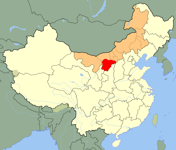
An SVG map of China with Inner Mongolia highlighted in orange and Ordos city highlighted in red Legend: |
||
| Date | |||
| Source |
self-made; based on CIA public domain maps:
and Wikimedia Commons work: |
||
| Author | Joowwww | ||
| Permission (Reusing this file) |
|
||
| Other versions |
|
||
| SVG development |


File history
Click on a date/time to view the file as it appeared at that time.
| Date/Time | Thumbnail | Dimensions | User | Comment | |
|---|---|---|---|---|---|
| current | 18:38, 9 February 2010 | | 1,000 × 850 (225 KB) | Joowwww | {{Information |Description=An SVG map of China with Inner Mongolia highlighted in orange and Ordos city highlighted in red Legend:<br />File:China map legend.png |Source=self-made; based on CIA public domain maps: *http://www.lib.utexas.edu/maps/mid |
File usage
The following page uses this file:
Global file usage
The following other wikis use this file:
- Usage on ar.wikipedia.org
- Usage on ceb.wikipedia.org
- Usage on de.wikipedia.org
- Usage on eo.wikipedia.org
- Usage on es.wikipedia.org
- Usage on eu.wikipedia.org
- Usage on fa.wikipedia.org
- Usage on fi.wikipedia.org
- Usage on fr.wikipedia.org
- Usage on id.wikipedia.org
- Usage on incubator.wikimedia.org
- Usage on ja.wikipedia.org
- Usage on mzn.wikipedia.org
- Usage on pl.wikiquote.org
- Usage on pt.wikipedia.org
- Usage on ru.wikipedia.org
- Usage on sh.wikipedia.org
- Usage on sv.wikipedia.org
- Usage on uk.wikipedia.org
- Usage on ur.wikipedia.org
- Usage on www.wikidata.org
- Usage on zh.wikipedia.org