File:DominicanRepublicSubdivisions.png
No higher resolution available.
DominicanRepublicSubdivisions.png (400 × 276 pixels, file size: 43 KB, MIME type: image/png)
| This is a file from the Wikimedia Commons. Information from its description page there is shown below. Commons is a freely licensed media file repository. You can help. |

|
This locator map image could be re-created using vector graphics as an SVG file. This has several advantages; see Commons:Media for cleanup for more information. If an SVG form of this image is available, please upload it and afterwards replace this template with
{{vector version available|new image name}}.
It is recommended to name the SVG file “DominicanRepublicSubdivisions.svg”—then the template Vector version available (or Vva) does not need the new image name parameter. |
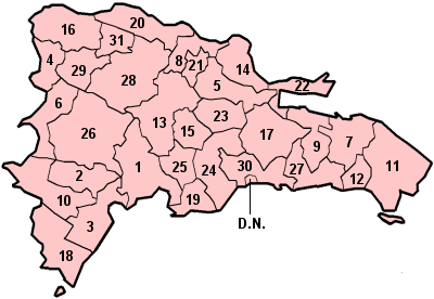
Original artwork derived mostly from CIA map, by User:Keith Edkins

|
Permission is granted to copy, distribute and/or modify this document under the terms of the GNU Free Documentation License, Version 1.2 or any later version published by the Free Software Foundation; with no Invariant Sections, no Front-Cover Texts, and no Back-Cover Texts. A copy of the license is included in the section entitled GNU Free Documentation License. |
| This file is licensed under the Creative Commons Attribution-Share Alike 3.0 Unported license. | ||
| ||
| This licensing tag was added to this file as part of the GFDL licensing update. |
File history
Click on a date/time to view the file as it appeared at that time.
| Date/Time | Thumbnail | Dimensions | User | Comment | |
|---|---|---|---|---|---|
| current | 23:16, 16 February 2009 | | 400 × 276 (43 KB) | Jmarcano | Reverted to version as of 22:18, 25 March 2005, the new version affects presentation in all wikis |
| 21:13, 16 February 2009 |  | 1,010 × 692 (54 KB) | MRDU08~commonswiki | Reverted to version as of 01:41, 8 February 2009 | |
| 21:24, 15 February 2009 |  | 400 × 276 (43 KB) | Jmarcano | Reverted to version as of 22:18, 25 March 2005; the new version affects all wikis | |
| 01:41, 8 February 2009 |  | 1,010 × 692 (54 KB) | MRDU08~commonswiki | Has better color and the colors of the flag of the country. | |
| 23:40, 1 February 2009 |  | 1,281 × 878 (60 KB) | MRDU08~commonswiki | It has the change of Salcedo Province to Hermanas Mirabal Province | |
| 22:18, 25 March 2005 |  | 400 × 276 (43 KB) | Jcb | Original artwork derived mostly from CIA map. {{GFDL}} |
File usage
The following 2 pages use this file:
Global file usage
The following other wikis use this file:
- Usage on ab.wikipedia.org
- Usage on ar.wikipedia.org
- Usage on ca.wikipedia.org
- Usage on cs.wikipedia.org
- Usage on el.wikipedia.org
- Usage on en.wikipedia.org
- Provinces of the Dominican Republic
- Coat of arms of the Dominican Republic
- List of Dominican Republic flags
- Ranked list of Dominican provinces
- Template:Lists of Provinces of the Dominican Republic
- List of Dominican Provinces by date of provincehood
- List of Dominican Republic Provinces by etymology
- List of Dominican Republic Provinces mottos
- List of provincial governors in the Dominican Republic
- Usage on es.wikipedia.org
- Usage on fi.wikipedia.org
- Usage on fr.wikipedia.org
- Usage on gl.wikipedia.org
- Usage on ha.wikipedia.org
- Usage on ht.wikipedia.org
- Usage on id.wikipedia.org
- Usage on ja.wikipedia.org
- Usage on ko.wikipedia.org
- Usage on lt.wikipedia.org
- Usage on nl.wikipedia.org
- Usage on pl.wikipedia.org
- Usage on pt.wikipedia.org
- Usage on ru.wikipedia.org
- Usage on sk.wikipedia.org
- Usage on sv.wikipedia.org
- Usage on tg.wikipedia.org
- Usage on uk.wikipedia.org
- Usage on ur.wikipedia.org
- جمہوریہ ڈومینیکن کے صوبے
- سانچہ:فہارست جمہوریہ ڈومینیکن کے صوبے
- جمہوریہ ڈومینیکن کے صوبوں کی درجہ بند فہرست
- فہرست جمہوریہ ڈومینیکن کے صوبائی گورنر
- فہرست جمہوریہ ڈومینیکن کے پرچم
- فہرست جمہوریہ ڈومینیکن کے صوبے بلحاظ تاریخ قیام
- فہرست جمہوریہ ڈومینیکن کے صوبے بلحاظ اشتقاقیات نام
- فہرست جمہوریہ ڈومینیکن کے صوبے بلحاظ شعار
- فہرست جمہوریہ ڈومینیکن کے صوبے بلحاظ نشان
- Usage on zh-min-nan.wikipedia.org
View more global usage of this file.