File:EF5damageMoore2013.jpg
Size of this preview: 800 × 600 pixels. Other resolutions: 320 × 240 pixels | 640 × 480 pixels | 1,024 × 768 pixels.
Original file (1,024 × 768 pixels, file size: 888 KB, MIME type: image/jpeg)
| This is a file from the Wikimedia Commons. Information from its description page there is shown below. Commons is a freely licensed media file repository. You can help. |
Summary
| Description |
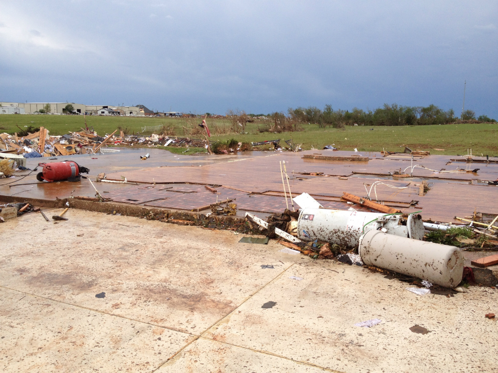
English: EF5 damage to a well-anchored house in Moore, OK. Slab foundation is swept completely clean. |
| Date | |
| Source | http://arcgis-nwsdatsecurestd-560264031.us-east-1.elb.amazonaws.com/arcgis/rest/services/DamageAssessmentToolkit/DamageFlexViewer/MapServer/0/142607/attachments/100436 |
| Author | NWS Norman, OK |
Licensing
This image is in the public domain because it contains materials that originally came from the U.S. National Oceanic and Atmospheric Administration, taken or made as part of an employee's official duties.
|
File history
Click on a date/time to view the file as it appeared at that time.
| Date/Time | Thumbnail | Dimensions | User | Comment | |
|---|---|---|---|---|---|
| current | 20:48, 13 March 2014 | | 1,024 × 768 (888 KB) | TornadoInformation12 | {{subst:Upload marker added by en.wp UW}} {{Information |Description = {{en|EF5 damage to a well-anchored house in Moore, OK. Slab foundation is swept completely clean.}} |Source = http://arcgis-nwsdatsecurestd-560264031.us-east-1.elb.amazonaws.com/arc... |
File usage
The following page uses this file:
Global file usage
The following other wikis use this file:
- Usage on de.wikipedia.org
- Usage on el.wikipedia.org
- Usage on en.wikipedia.org
- Usage on es.wikipedia.org
- Usage on eu.wikipedia.org
- Usage on fr.wikipedia.org
- Usage on ko.wikipedia.org
- Usage on no.wikipedia.org
- Usage on ru.wikipedia.org
- Usage on th.wikipedia.org