File:Fort Ouiatenon marker.png
Size of this preview: 800 × 343 pixels. Other resolutions: 320 × 137 pixels | 640 × 274 pixels | 1,024 × 439 pixels | 2,100 × 900 pixels.
Original file (2,100 × 900 pixels, file size: 3.61 MB, MIME type: image/png)
| This is a file from the Wikimedia Commons. Information from its description page there is shown below. Commons is a freely licensed media file repository. You can help. |
Summary
| Camera location | | View this and other nearby images on: OpenStreetMap |
|---|
| Description |
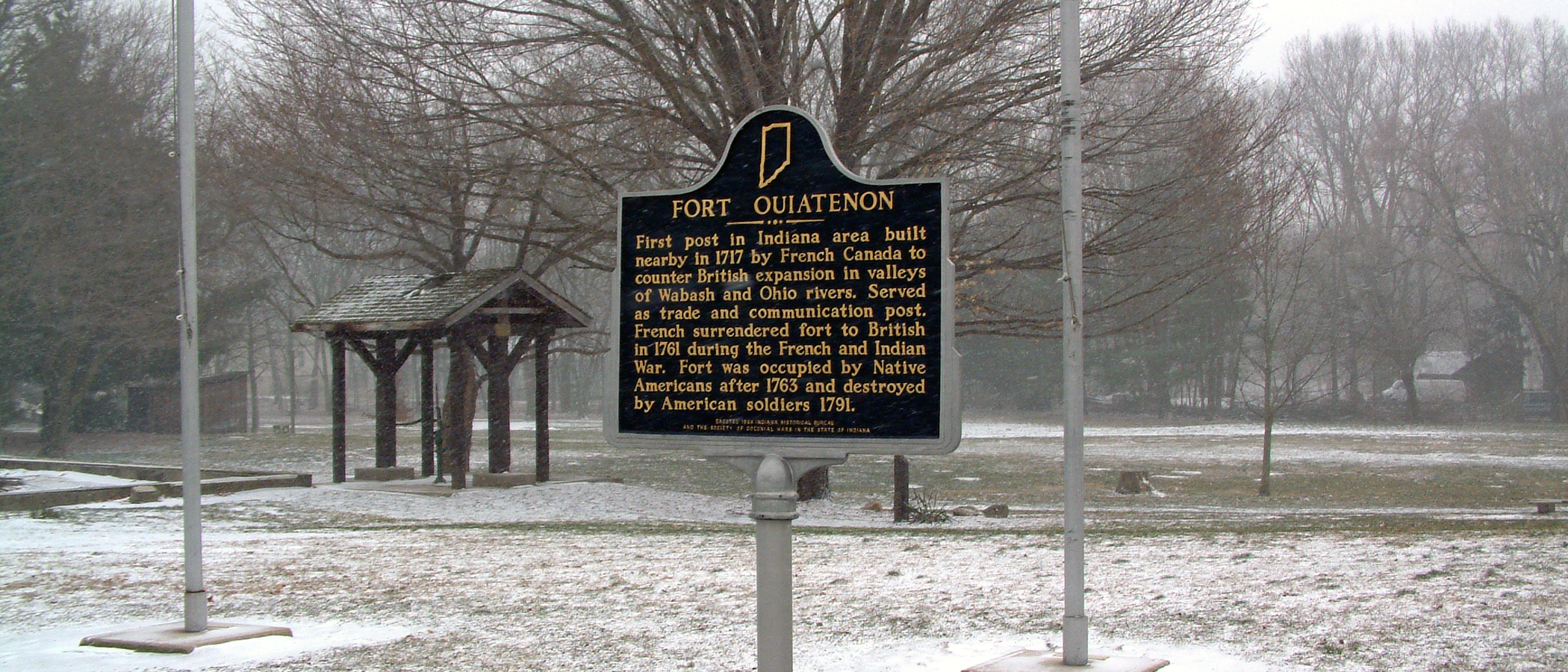
The historical marker at Fort Ouiatenon in Tippecanoe County, Indiana. It reads:
|
| Date | |
| Source | Self-photographed |
| Author | Huw Williams (Huwmanbeing) |
| Permission (Reusing this file) |
I release this photo into the public domain |
Licensing
| I, the copyright holder of this work, release this work into the public domain. This applies worldwide. In some countries this may not be legally possible; if so: I grant anyone the right to use this work for any purpose, without any conditions, unless such conditions are required by law. |
File history
Click on a date/time to view the file as it appeared at that time.
| Date/Time | Thumbnail | Dimensions | User | Comment | |
|---|---|---|---|---|---|
| current | 22:48, 28 January 2007 | | 2,100 × 900 (3.61 MB) | Huwmanbeing | {{Information |Description = The historical marker at Fort Ouiatenon in Tippecanoe County, Indiana. |Source = Own photo |Date = 2007-01-28 |Author = Huw Williams (Huwmanbeing) |Permission = I release this photo into the public domain |
File usage
The following page uses this file:
Global file usage
The following other wikis use this file:
- Usage on en.wikipedia.org
- Usage on fr.wikipedia.org
- Usage on www.wikidata.org