File:Hallig Gröde, Germany, view from the marina.jpg
Size of this preview: 800 × 519 pixels. Other resolutions: 320 × 208 pixels | 640 × 416 pixels | 1,024 × 665 pixels | 1,280 × 831 pixels | 2,312 × 1,501 pixels.
Original file (2,312 × 1,501 pixels, file size: 3.4 MB, MIME type: image/jpeg)
| This is a file from the Wikimedia Commons. Information from its description page there is shown below. Commons is a freely licensed media file repository. You can help. |
Summary
| Description |
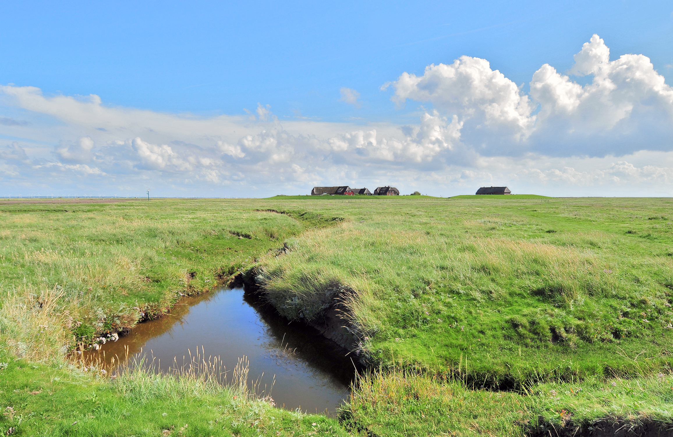
Deutsch: Blick auf die Hallig Gröde. Die Hallig Gröde ist eine der zehn Halligen in dem Nationalpark Schleswig-Holsteinisches Wattenmeer. Hallig Gröde ist fast ganz von einer Steinkante umgeben und ist dadurch bei Sturmfluten vor Landverlust geschützt. Dennoch wird die Hallig Gröde durchschnittlich zwanzig bis dreißig Mal im Jahr bei Landunter vollständig überflutet. Vier Wohnhäuser stehen auf der Knudtswarft (links), und die Kirche mit der Schule und der Lehrerwohnung steht auf der Kirchwarft (rechts). Beide Warften sind von Ringdeichen umgeben, damit sie den Sturmfluten widerstehen können. Die Wohnhäuser besitzen im 1. Stock einen Schutzraum, der auf vier Betonpfeilern steht, die etwa vier Meter im Warftboden gegründet sind. Auf der Knudtswarft befindet sich zwischen den Gebäuden der Fething mit Regenwasser. Auf der Kirchwarft liegt der Friedhof neben dem Kirchen- und Schulgebäude. Seit 1976 ist die Hallig Gröde mit einer Strom- und Wasserleitung mit dem Festland verbunden, es gibt eine Telefonleitung. Die Häuser werden mit Strom beheizt.
English: View to the Hallig Gröde. The Hallig Gröde is an islets in the Schleswig-Holstein Wadden Sea National Park. Hallig Gröde is not protected from storm surges, she is flooded completely twenty to thirty times a year. The Houses are built on high mounds with dykes. Therefore they can withstand the storm surges. The Hallig Gröde has two mounds. The Knudtswarft (left) has four buildings and a pond with rainwater. The Kirchwarft (right) has the graveyard and one building with the church and the school. |
| Date | |
| Source | Own work |
| Author | Michael Gäbler |
| Attribution (required by the license) | © Michael Gäbler / Wikimedia Commons / |
| Camera location | | View this and other nearby images on: OpenStreetMap |
|---|
Licensing
I, the copyright holder of this work, hereby publish it under the following license:
This file is licensed under the Creative Commons Attribution-Share Alike 3.0 Unported license.
- You are free:
- to share – to copy, distribute and transmit the work
- to remix – to adapt the work
- Under the following conditions:
- attribution – You must give appropriate credit, provide a link to the license, and indicate if changes were made. You may do so in any reasonable manner, but not in any way that suggests the licensor endorses you or your use.
- share alike – If you remix, transform, or build upon the material, you must distribute your contributions under the same or compatible license as the original.
| Annotations | This image is annotated: View the annotations at Commons |
File history
Click on a date/time to view the file as it appeared at that time.
| Date/Time | Thumbnail | Dimensions | User | Comment | |
|---|---|---|---|---|---|
| current | 00:36, 16 October 2012 | | 2,312 × 1,501 (3.4 MB) | Michael Gäbler | {{Information |Description= {{de|1= Blick auf die Hallig Gröde. Die Hallig Gröde ist eine der zehn Halligen in dem [[:de:Nationalpark Schleswig-Holsteinisches Wattenmeer|Nationalpark Schleswig-Holsteinisch... |
File usage
The following page uses this file:
Global file usage
The following other wikis use this file:
- Usage on ca.wikipedia.org
- Usage on ceb.wikipedia.org
- Usage on ce.wikipedia.org
- Usage on da.wikipedia.org
- Usage on de.wikipedia.org
- Usage on de.wikivoyage.org
- Usage on en.wikipedia.org
- Usage on en.wikivoyage.org
- Usage on eo.wikipedia.org
- Usage on es.wikipedia.org
- Usage on eu.wikipedia.org
- Usage on hu.wikipedia.org
- Usage on lld.wikipedia.org
- Usage on mk.wikipedia.org
- Usage on no.wikipedia.org
- Usage on pl.wikipedia.org
- Usage on ro.wikipedia.org
- Usage on ru.wikipedia.org
- Usage on sr.wikipedia.org
- Usage on sv.wikipedia.org
- Usage on tr.wikipedia.org
- Usage on tt.wikipedia.org
- Usage on uk.wikipedia.org
- Usage on uz.wikipedia.org
- Usage on vi.wikipedia.org
- Usage on www.wikidata.org
- Usage on zh-min-nan.wikipedia.org