File:India Haryana location map.svg

Size of this PNG preview of this SVG file: 563 × 599 pixels. Other resolutions: 226 × 240 pixels | 451 × 480 pixels | 722 × 768 pixels | 962 × 1,024 pixels | 1,925 × 2,048 pixels | 845 × 899 pixels.
Original file (SVG file, nominally 845 × 899 pixels, file size: 253 KB)
| This is a file from the Wikimedia Commons. Information from its description page there is shown below. Commons is a freely licensed media file repository. You can help. |
Summary
| Description |
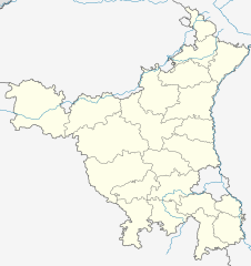
Location map of Haryana Geographic limits of the map:
|
| Date | |
| Source | |
| Author |
|
Licensing
This file is licensed under the Creative Commons Attribution-Share Alike 3.0 Unported license.
- You are free:
- to share – to copy, distribute and transmit the work
- to remix – to adapt the work
- Under the following conditions:
- attribution – You must give appropriate credit, provide a link to the license, and indicate if changes were made. You may do so in any reasonable manner, but not in any way that suggests the licensor endorses you or your use.
- share alike – If you remix, transform, or build upon the material, you must distribute your contributions under the same or compatible license as the original.
File history
Click on a date/time to view the file as it appeared at that time.
| Date/Time | Thumbnail | Dimensions | User | Comment | |
|---|---|---|---|---|---|
| current | 17:46, 28 April 2023 | | 845 × 899 (253 KB) | C1MM | Fixed districts |
| 04:53, 13 August 2021 |  | 845 × 899 (213 KB) | C1MM | c bounds | |
| 05:16, 25 October 2020 |  | 626 × 750 (381 KB) | C1MM | Updated districts | |
| 17:47, 24 October 2020 |  | 626 × 750 (373 KB) | C1MM | Added new district | |
| 04:09, 11 June 2016 |  | 626 × 750 (373 KB) | Milenioscuro | rivers | |
| 05:28, 27 May 2013 |  | 954 × 1,188 (92 KB) | Milenioscuro | {{Information |Description ={{en|1=India_Haryana_location_map}} {{es|1=India_Haryana_location_map}} |Source =File:Haryana locator map.svg |Author =User:Shadowxfox |Date =2013-05-26 |Permission = |other_versions... |
File usage
The following 6 pages use this file:
Global file usage
The following other wikis use this file:
- Usage on azb.wikipedia.org
- سونیپات
- جارلی
- فولان (هیندوستان)
- فالقو تیرت
- سارسود
- سارسا, بیوانی
- سارولا
- سارال, بیوانی
- سانقرولی
- ماسودپور
- ماستاپور
- ماسانی
- کالالی, بیوانی
- ساماسپور ماجرا
- کاکرولی ساردارا
- کاکرولی هوکمی
- کاکرولی هاتی
- سالهاواس
- سالهاواس, رواری
- کاکاوت
- کایمری, حیصار
- کایملا
- مانسارباس
- سای, بیوانی
- ساهاروا
- ساهارانواس
- سادهانواس
- مانقواکی
- مانقرا
- کابلانا
- مانقار بانی
- مانقالی
- مانتی (هیندوستان)
- مانسار
- روجهوواس
- روهرای
- روهنات
- ماندوتی
- ریواسا
- جوندلا
- جوی خورد
- رواری خرا
- رواری خرا, بیوانی
- رواری بلوک اوف رواری دیستریکت
- ماندهولی خورد
- ماندهانا, بیوانی
- جوری, قوروقرام
- جونیاواس
- رهرودهی
- جیتپور ایستامرار
View more global usage of this file.