File:India Kerala location map.svg

Original file (SVG file, nominally 874 × 1,274 pixels, file size: 350 KB)
| This is a file from the Wikimedia Commons. Information from its description page there is shown below. Commons is a freely licensed media file repository. You can help. |
Summary
| Description |
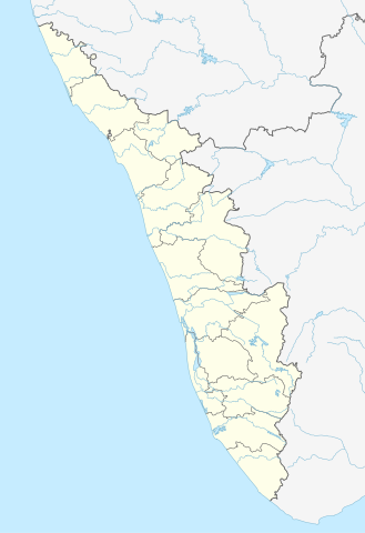
Quadratische Plattkarte, N-S-Streckung 102 %. Geographische Begrenzung der Karte:
Equirectangular projection, N/S stretching 102 %. Geographic limits of the map:
|
|
| Date | ||
| Source |
Own work, using
|
|
| Author | NordNordWest | |
| Permission (Reusing this file) |
This file is licensed under the Creative Commons Attribution-Share Alike 3.0 Germany license.
 This file is licensed under the Creative Commons Attribution-Share Alike 3.0 Unported license.
|


|
This map has been made or improved in the German Kartenwerkstatt (Map Lab). You can propose maps to improve as well.
|
File history
Click on a date/time to view the file as it appeared at that time.
| Date/Time | Thumbnail | Dimensions | User | Comment | |
|---|---|---|---|---|---|
| current | 16:13, 10 June 2023 | | 874 × 1,274 (350 KB) | C1MM | c boundaries |
| 16:04, 10 June 2023 |  | 874 × 1,274 (351 KB) | C1MM | c bounds | |
| 14:41, 22 August 2021 |  | 775 × 1,129 (394 KB) | C1MM | Corrected rivers and dist boundaries | |
| 18:17, 4 May 2012 |  | 827 × 1,205 (135 KB) | NordNordWest | upd | |
| 09:30, 11 March 2011 |  | 827 × 1,205 (132 KB) | NordNordWest | =={{int:filedesc}}== {{Information |Description= {{de|Positionskarte von Kerala, Indien}} Quadratische Plattkarte, N-S-Streckung 102 %. Geographische Begrenzung der Karte: * N: 13.0° N * S: 8.0° N * W: 74.5° O * O: 78.0° |
File usage
The following 84 pages use this file:
- Adichanalloor
- Adinad
- Alappad
- Alappuzha
- Alayamon
- Alimukku
- Alumpeedika
- Ammakandakara
- Anchalumoodu
- Angadi
- Angadickal
- Arackal
- Aryankavu
- Avaneeswaram
- Ayanivelikulangara
- Ayiranalloor
- Ayiroor
- Chandanapally
- Chathenkary
- Chenneerkara
- Chittar
- Chunkappara
- Clappana
- Edakkidom
- Edamon
- Edamulackal
- Elamad
- Elampalloor
- Elikkattoor
- Enathu
- Eraviperoor
- Ezhukone
- Kadakkad
- Kalanjoor
- Kallelibhagom
- Kallooppara
- Kandachira
- Kannanalloor
- Karunagappally
- Kattoor, Pathanamthitta
- Kerala
- Kottangal
- Kulanada
- Kumaranalloor
- Kumbanad
- Kundayam
- Kunnamthanam
- Kunnathur, Kerala
- Madamon
- Mahé, India
- Malamel
- Manappally
- Manchalloor
- Mancode
- Mathra
- Meenad
- Melila, India
- Mylom
- Neduvannoor
- Ochira
- Panampatta
- Panaveli
- Pandalam
- Panmana
- Pathanapuram
- Pathanapuram Block Panchayat
- Pathiyanadu Sree Bhadrakali Temple
- Pavumba
- Payyanur
- Pidavoor
- Poruvazhy
- Punnala
- Randalummoodu
- Thazhava
- Thenmala
- Thevalakkara
- Umayanalloor
- Vadakkumthala
- Vilakkudy
- Vilakkuvettom
- Wayanad
- Yeroor
- Module:Location map/data/India Kerala
- Module:Location map/data/India Kerala/doc
Global file usage
The following other wikis use this file:
- Usage on ar.wikipedia.org
- Usage on azb.wikipedia.org
- باتی چاتالور
- باتی پودوسری
- پیدیکاپارامبو
- پیداوور
- وایاتوپوژا
- وئیلور
- پرووانتانام
- پرووالور
- پرووا (هیندوستان)
- پرونا (هیندوستان)
- پرونیلام
- واوانور
- پرونقوژی
- وانیمال
- وانییامبالام
- ونیکود
- ونجینیسری
- ونقانور
- سارکارا-چیرایینکیژو
- سانتانپارا
- ماژووانور
- ماژوکیر
- کالکونتال
- کالیکاو
- ماترا (هیندوستان)
- ماتیلاکام
- ماتامبا
- کالایاپورام
- کالاتوکاداوو
- کالانجور
- ونقانلور
- ونقولا
- ماروتا, ایندیا
- کالامپالا
- ونقارا, مالاپورام دیستریکت
- ونکیتانقو
- کالاکتی
- واندیتاوالام
- واندانمدو
- واندانپاتال
- وانداماتوم
- وانداژی-یی
- وانداژی-ی
- ونجارامودو
- ونپاکال
- کاکور (هیندوستان)
- ماریاناد
- کاکولیسری
- کاکودی
View more global usage of this file.