File:Judetul Brasov 3D map.jpg
Size of this preview: 800 × 576 pixels. Other resolutions: 320 × 230 pixels | 640 × 460 pixels | 1,062 × 764 pixels.
Original file (1,062 × 764 pixels, file size: 184 KB, MIME type: image/jpeg)
| This is a file from the Wikimedia Commons. Information from its description page there is shown below. Commons is a freely licensed media file repository. You can help. |
Summary
| Description |
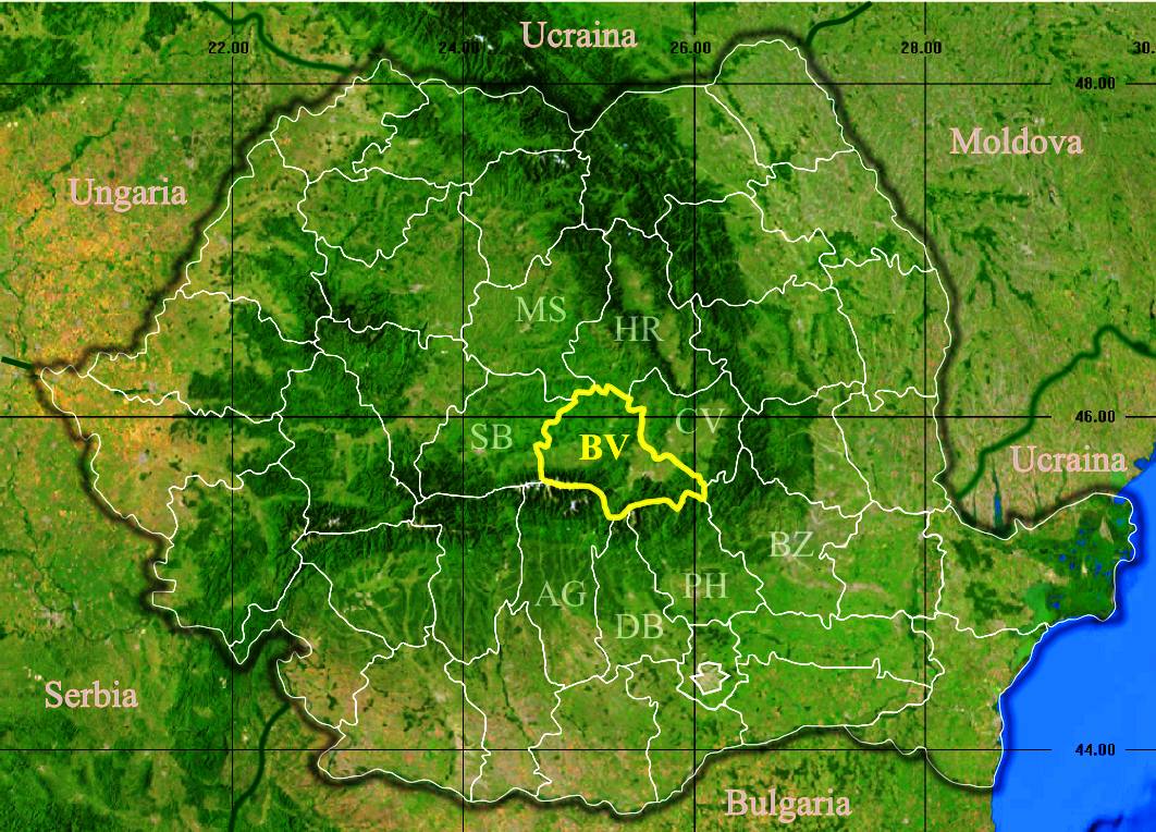
English: Location of Brașov County in Romania. Deutsch: Lage der Kreis Brașov in Rumänien. Română: Localizarea județului Brașov în România. |
| Date | |
| Source |
|
| Author | Asybaris01 |
Licensing
| This image is in the public domain because it is a screenshot from NASA’s globe software World Wind using a public domain layer, such as Blue Marble, MODIS, Landsat, SRTM, USGS or GLOBE.
|
 |
File history
Click on a date/time to view the file as it appeared at that time.
| Date/Time | Thumbnail | Dimensions | User | Comment | |
|---|---|---|---|---|---|
| current | 10:57, 27 November 2011 | | 1,062 × 764 (184 KB) | Asybaris01 | contur |
| 10:52, 27 November 2011 |  | 1,062 × 764 (197 KB) | Asybaris01 | vecini | |
| 08:55, 27 November 2011 |  | 924 × 665 (112 KB) | Asybaris01 | {{Information |Description ={{ro|1=Judetul Brasov 3D map.}} |Source =Topographic data SRTM from NASA and World Imagery - NASA World Wind & 3Dem & Inkscape |Author =Asybaris01 |Date =nov 2011 |Permission |
File usage
There are no pages that use this file.
Global file usage
The following other wikis use this file:
- Usage on ace.wikipedia.org
- Usage on da.wikipedia.org
- Usage on hr.wikipedia.org
- Usage on mk.wikipedia.org
- Usage on ms.wikipedia.org
- Usage on pl.wikipedia.org
- Usage on ro.wikipedia.org
- Usage on ro.wikivoyage.org
- Usage on sk.wikipedia.org
- Usage on sv.wikipedia.org