File:Location Nagorno-Karabakh2.png
No higher resolution available.
Location_Nagorno-Karabakh2.png (595 × 387 pixels, file size: 75 KB, MIME type: image/png)
| This is a file from the Wikimedia Commons. Information from its description page there is shown below. Commons is a freely licensed media file repository. You can help. |

|
This locator map image could be re-created using vector graphics as an SVG file. This has several advantages; see Commons:Media for cleanup for more information. If an SVG form of this image is available, please upload it and afterwards replace this template with
{{vector version available|new image name}}.
It is recommended to name the SVG file “Location Nagorno-Karabakh2.svg”—then the template Vector version available (or Vva) does not need the new image name parameter. |
Summary
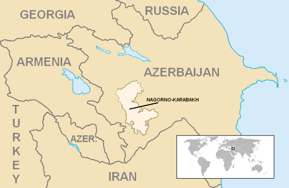
| Description | Location of en:Azerbaijan. World inset added by en:User:Kmusser. | ||
| Date | |||
| Source | Azerbaijan districts numbered.png, ArmeniaNumbered.png, Gg-map.png, and Iran map.png | ||
| Author | en:User:Aivazovsky | ||
| Permission (Reusing this file) |
|
||
| Other versions | http://en.wikipedia.org/wiki/Image:Location_Nagorno-Karabakh.png |
File history
Click on a date/time to view the file as it appeared at that time.
| Date/Time | Thumbnail | Dimensions | User | Comment | |
|---|---|---|---|---|---|
| current | 19:15, 19 December 2006 | | 595 × 387 (75 KB) | Kmusser | Nagorno-Karabakh Category:Maps of Nagorno-Karabakh == Summary == {{Information World inset added by en:User:Kmusser. |Description=Location of en:Nagorno-Karabakh |Source=[[:en:Image:Azerb |
File usage
The following page uses this file:
Global file usage
The following other wikis use this file:
- Usage on ami.wikipedia.org
- Usage on ar.wikipedia.org
- Usage on arz.wikipedia.org
- Usage on ast.wikipedia.org
- Usage on azb.wikipedia.org
- Usage on az.wikipedia.org
- Usage on az.wiktionary.org
- Usage on ban.wikipedia.org
- Usage on ba.wikipedia.org
- Usage on be-tarask.wikipedia.org
- Usage on be.wikipedia.org
- Usage on bn.wikipedia.org
- Usage on br.wikipedia.org
- Usage on bs.wikipedia.org
- Usage on ca.wikipedia.org
- Usage on ckb.wikipedia.org
- Usage on cs.wikipedia.org
- Usage on cv.wikipedia.org
- Usage on cy.wikipedia.org
- Usage on de.wikipedia.org
- Usage on el.wikipedia.org
- Usage on en.wikipedia.org
- Nagorno-Karabakh
- User:Kmusser/Images
- Nagorno-Karabakh Autonomous Oblast
- Land mines in Nagorno-Karabakh
- Wikipedia:WikiProject Armenia/User Boxes
- User:Megastrike14
- Template:User Nagorno Karabakh2
- Template:User wpnk2
- Outline of the Republic of Artsakh
- Wikipedia:WikiProject Artsakh
- User:Progint/sandbox/Togli Qorabog
- User:Falcaorib
- Wikipedia:Userboxes/WikiProjects/alphabetical/19
- Wikipedia:Userboxes/WikiProjects/Regional/07
- Talk:Blockade of Nagorno-Karabakh/Archive 2
- Usage on en.wikinews.org
- Usage on en.wikiversity.org
- Usage on en.wiktionary.org
- Usage on eo.wikipedia.org
- Usage on fa.wikipedia.org
- Usage on fo.wikipedia.org
- Usage on fr.wikipedia.org
View more global usage of this file.