File:México División Política-República Central.png
Size of this preview: 557 × 599 pixels. Other resolutions: 223 × 240 pixels | 446 × 480 pixels | 714 × 768 pixels | 1,098 × 1,181 pixels.
Original file (1,098 × 1,181 pixels, file size: 319 KB, MIME type: image/png)
| This is a file from the Wikimedia Commons. Information from its description page there is shown below. Commons is a freely licensed media file repository. You can help. |
| Description |
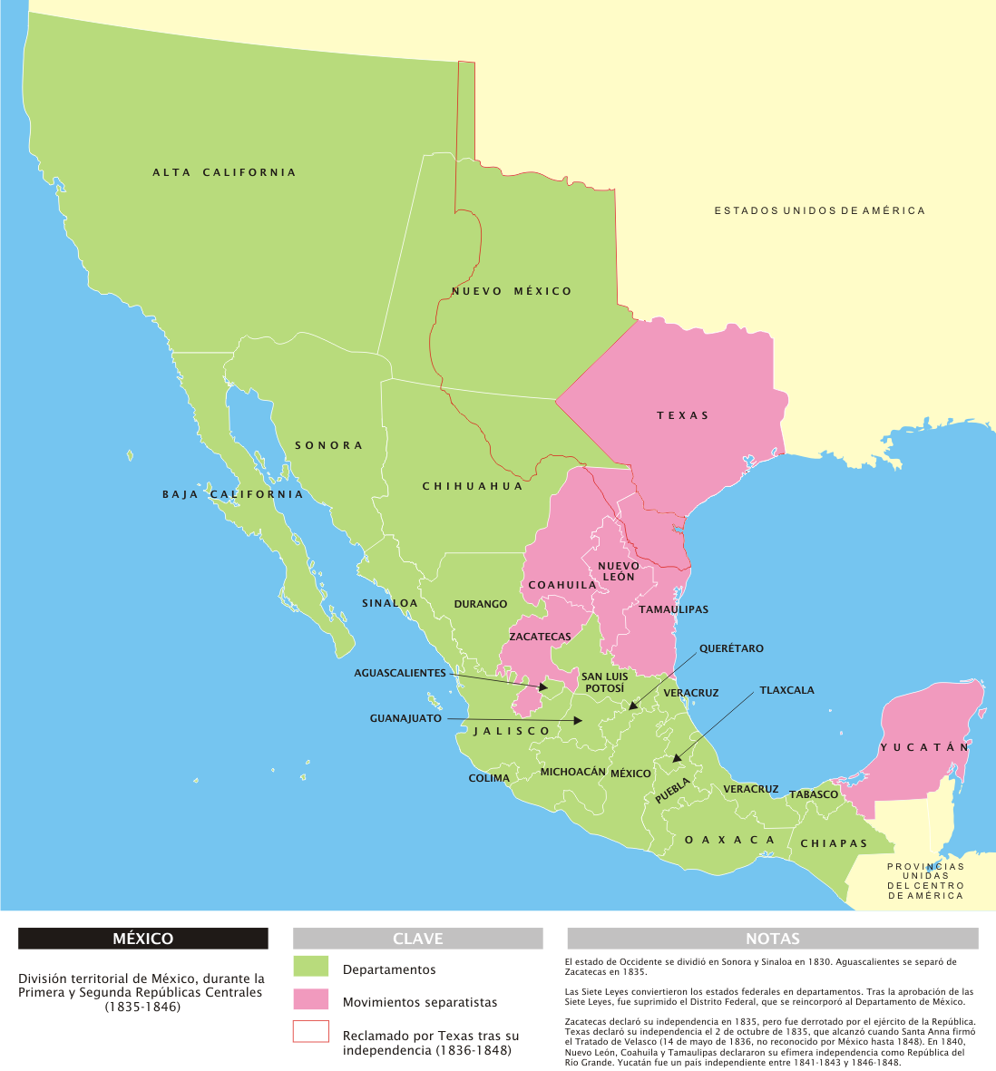
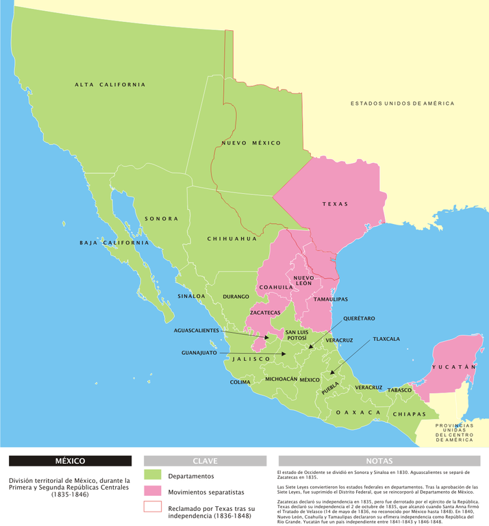
[] Deutsch: Administrative Karte Mexikos in den Jahren 1835-1846. English: Administrative map of Mexico during the two central republics (1835-1846). Español: Mapa de la organización territorial de México durante las Repúblicas Centralistas (1835-1846). Français : Carte du Mexique durant les deux républiques centrales (1935-1846). |
|||
| Date | ||||
| Source | Own work | |||
| Author | Yavidaxiu | |||
| Permission (Reusing this file) |
|
|||
| Other versions |
[]
| |||
| PNG development | This diagram was created with Inkscape. This diagram uses embedded text that can be easily translated using a text editor. |


.svg)


File history
Click on a date/time to view the file as it appeared at that time.
| Date/Time | Thumbnail | Dimensions | User | Comment | |
|---|---|---|---|---|---|
| current | 14:53, 29 March 2007 | | 1,098 × 1,181 (319 KB) | Yavidaxiu | {{Information |Description={{es|Mapa de la organización territorial de México durante las Repúblicas Centralistas (1835-1846), con notas en español.}} |Source=Trabajo propio |Date=29 de marzo de 2007 |Author=Yavidaxiu |Permission={{PD-self}} |other_v |
File usage
The following page uses this file:
Global file usage
The following other wikis use this file:
- Usage on bs.wikipedia.org
- Usage on cs.wikipedia.org
- Usage on cv.wikipedia.org
- Usage on el.wikipedia.org
- Usage on fr.wikipedia.org
- Usage on hy.wikipedia.org
- Usage on hyw.wikipedia.org
- Usage on lij.wikipedia.org
- Usage on lt.wikipedia.org
- Usage on nl.wikipedia.org
- Usage on no.wikipedia.org
- Usage on pl.wikipedia.org
- Usage on uk.wikipedia.org
- Usage on vi.wikipedia.org
- Usage on zh.wikipedia.org