File:Map of Utah highlighting Salt Lake County.svg

Size of this PNG preview of this SVG file: 480 × 599 pixels. Other resolutions: 192 × 240 pixels | 384 × 480 pixels | 615 × 768 pixels | 820 × 1,024 pixels | 1,640 × 2,048 pixels | 4,457 × 5,566 pixels.
Original file (SVG file, nominally 4,457 × 5,566 pixels, file size: 56 KB)
| This is a file from the Wikimedia Commons. Information from its description page there is shown below. Commons is a freely licensed media file repository. You can help. |
Summary
| Description |
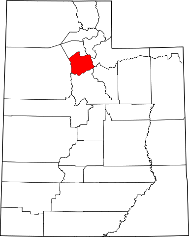
English: This is a locator map showing Salt Lake County in Utah. For more information, see Commons:United States county locator maps. |
| Date | |
| Source |
Own work: English: The maps use data from nationalatlas.gov, specifically countyp020.tar.gz on the Raw Data Download page. The maps also use state outline data from statesp020.tar.gz. The Florida maps use hydrogm020.tar.gz to display Lake Okeechobee. |
| Author | David Benbennick |
Licensing
| I, the copyright holder of this work, release this work into the public domain. This applies worldwide. In some countries this may not be legally possible; if so: I grant anyone the right to use this work for any purpose, without any conditions, unless such conditions are required by law. |
File history
Click on a date/time to view the file as it appeared at that time.
| Date/Time | Thumbnail | Dimensions | User | Comment | |
|---|---|---|---|---|---|
| current | 17:35, 12 February 2006 | | 4,457 × 5,566 (56 KB) | David Benbennick | {{subst:User:Dbenbenn/clm|county=Salt Lake County|state=Utah|type=county}} |
File usage
The following 21 pages use this file:
- Alta, Utah
- Bingham Canyon, Utah
- Bluffdale, Utah
- Cottonwood Heights, Utah
- Draper, Utah
- Herriman, Utah
- Holladay, Utah
- List of counties in Utah
- Midvale, Utah
- Millcreek, Utah
- Murray, Utah
- Riverton, Utah
- Salt Lake City
- Salt Lake County, Utah
- Sandy, Utah
- South Jordan, Utah
- South Salt Lake, Utah
- Taylorsville, Utah
- West Jordan, Utah
- West Valley City, Utah
- Template:Salt Lake County, Utah
Global file usage
The following other wikis use this file:
- Usage on ar.wikipedia.org
- سولت ليك (مدينة)
- مقاطعة سولت ليك (يوتا)
- جوردن الجنوبية
- ويست فالي سيتي
- ويست جوردان
- ساندي (يوتا)
- موراي (يوتا)
- تايلورزفيل (يوتا)
- ميدفال
- درابر
- ريفرتون (يوتا)
- كوتنوود هايتس
- هولاداي
- بلوفديل
- هيريمان
- قائمة مقاطعات يوتا
- ماجنا (يوتا)
- وايت (يوتا)
- كيرنز (يوتا)
- غرانيت (يوتا)
- قالب:مقاطعة سولت ليك (يوتا)
- ميلكريك (يوتا)
- Usage on azb.wikipedia.org
- Usage on be.wikipedia.org
- Usage on bg.wikipedia.org
- Usage on bpy.wikipedia.org
- Usage on bs.wikipedia.org
- Usage on cdo.wikipedia.org
- Usage on ceb.wikipedia.org
- Usage on ce.wikipedia.org
- Usage on cs.wikipedia.org
- Usage on cy.wikipedia.org
- Usage on de.wikipedia.org
View more global usage of this file.