File:Map of Virginia highlighting Fauquier County.svg

Size of this PNG preview of this SVG file: 800 × 347 pixels. Other resolutions: 320 × 139 pixels | 640 × 278 pixels | 1,024 × 444 pixels | 1,280 × 555 pixels | 2,560 × 1,110 pixels | 7,486 × 3,247 pixels.
Original file (SVG file, nominally 7,486 × 3,247 pixels, file size: 223 KB)
| This is a file from the Wikimedia Commons. Information from its description page there is shown below. Commons is a freely licensed media file repository. You can help. |
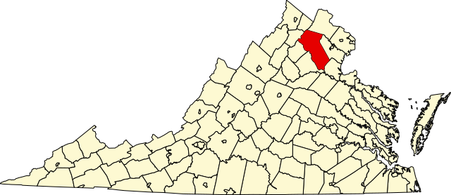
This is a locator map showing Fauquier County in Virginia.
This W3C-invalid map was created with an unknown SVG tool.
David Benbennick made this map. For more information, see Commons:United States county locator maps.
| I, the copyright holder of this work, release this work into the public domain. This applies worldwide. In some countries this may not be legally possible; if so: I grant anyone the right to use this work for any purpose, without any conditions, unless such conditions are required by law. |
File history
Click on a date/time to view the file as it appeared at that time.
| Date/Time | Thumbnail | Dimensions | User | Comment | |
|---|---|---|---|---|---|
| current | 17:43, 12 February 2006 | | 7,486 × 3,247 (223 KB) | David Benbennick | {{subst:User:Dbenbenn/clm|county=Fauquier County|state=Virginia|type=county}} |
File usage
The following 2 pages use this file:
Global file usage
The following other wikis use this file:
- Usage on ar.wikipedia.org
- Usage on bg.wikipedia.org
- Usage on bpy.wikipedia.org
- Usage on cdo.wikipedia.org
- Usage on ceb.wikipedia.org
- Usage on ce.wikipedia.org
- Usage on cy.wikipedia.org
- Usage on de.wikipedia.org
- Usage on en.wikipedia.org
- List of cities and counties in Virginia
- Fauquier County, Virginia
- Remington, Virginia
- The Plains, Virginia
- Warrenton, Virginia
- Germantown, Virginia
- Category:Fauquier County, Virginia
- Sumerduck, Virginia
- Bealeton, Virginia
- Catlett, Virginia
- Marshall, Virginia
- Midland, Virginia
- Upperville, Virginia
- Hume, Virginia
- Portal:American Civil War/Featured article
- Goldvein, Virginia
- Little River (Goose Creek tributary)
- Linden, Virginia
- Casanova, Virginia
- Manassas Gap
- Airlie, Virginia
- Belle Meade, Virginia
- Belvoir, Virginia
- Bristersburg, Virginia
- Broad Run, Virginia
- Calverton, Virginia
- Delaplane, Virginia
- Elk Run, Virginia
- Halfway, Virginia
- Markham, Fauquier County, Virginia
- Kelly's Ford, Virginia
- Paris, Virginia
- Template:Fauquier County, Virginia
View more global usage of this file.