File:Mauritius Island topographic map-de.svg

Size of this PNG preview of this SVG file: 502 × 599 pixels. Other resolutions: 201 × 240 pixels | 402 × 480 pixels | 643 × 768 pixels | 858 × 1,024 pixels | 1,716 × 2,048 pixels | 1,810 × 2,160 pixels.
Original file (SVG file, nominally 1,810 × 2,160 pixels, file size: 1.93 MB)
| This is a file from the Wikimedia Commons. Information from its description page there is shown below. Commons is a freely licensed media file repository. You can help. |

| Description |
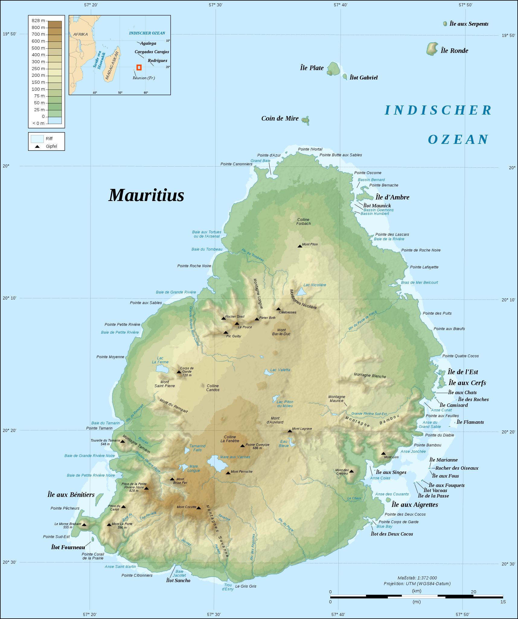
Deutsch: Topografische Karte von Mauritius, deutsche Version.
English: Topographic map in German of Mauritius Island.
|
| Date | |
| Source |
Own work;
|
| Author | Eric Gaba (Sting - fr:Sting); translated by NordNordWest |
| Permission (Reusing this file) |
GFDL / Creative Commons Attribution and Share-Alike required |
| Other versions |
[]
|


| Camera location | | View this and other nearby images on: OpenStreetMap |
|---|
Licensing
I, the copyright holder of this work, hereby publish it under the following licenses:

|
Permission is granted to copy, distribute and/or modify this document under the terms of the GNU Free Documentation License, Version 1.2 or any later version published by the Free Software Foundation; with no Invariant Sections, no Front-Cover Texts, and no Back-Cover Texts. A copy of the license is included in the section entitled GNU Free Documentation License. |
This file is licensed under the Creative Commons Attribution-Share Alike 4.0 International, 3.0 Unported, 2.5 Generic, 2.0 Generic and 1.0 Generic license.
- You are free:
- to share – to copy, distribute and transmit the work
- to remix – to adapt the work
- Under the following conditions:
- attribution – You must give appropriate credit, provide a link to the license, and indicate if changes were made. You may do so in any reasonable manner, but not in any way that suggests the licensor endorses you or your use.
- share alike – If you remix, transform, or build upon the material, you must distribute your contributions under the same or compatible license as the original.
You may select the license of your choice.
File history
Click on a date/time to view the file as it appeared at that time.
| Date/Time | Thumbnail | Dimensions | User | Comment | |
|---|---|---|---|---|---|
| current | 20:16, 10 February 2009 | | 1,810 × 2,160 (1.93 MB) | NordNordWest | {{Location|20|15|00|S|57|35|00|E|scale:500000}} <br/> {{Information |Description={{de|Topografische Karte von Mauritius, deutsche Version.}} {{en|Topographic map in German of Mauritius Island.}} {{fr|Carte topographique |
File usage
The following page uses this file:
Global file usage
The following other wikis use this file:
- Usage on de.wikipedia.org
- Usage on ka.wikipedia.org
- Usage on nds.wikipedia.org
- Usage on nl.wikipedia.org
- Usage on pt.wikipedia.org
- Usage on stq.wikipedia.org