File:Neusiedler Lake satellite.png
Size of this preview: 510 × 600 pixels. Other resolutions: 204 × 240 pixels | 408 × 480 pixels | 797 × 937 pixels.
Original file (797 × 937 pixels, file size: 1.39 MB, MIME type: image/png)
| This is a file from the Wikimedia Commons. Information from its description page there is shown below. Commons is a freely licensed media file repository. You can help. |
Summary
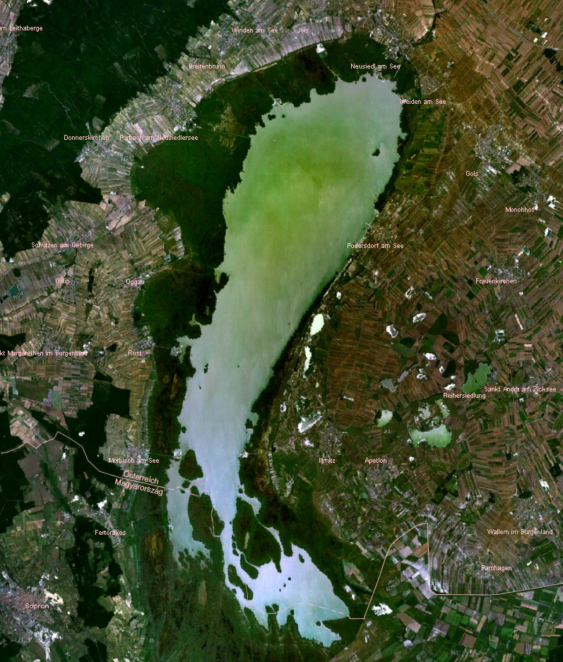
Satellite view of Neusiedler Lake in Austria / Fertő-tó in Hungary. Taken from de:Bild:Neusiedlersee NASA WorldWind.png.
Licensing
| This image is in the public domain because it is a screenshot from NASA’s globe software World Wind using a public domain layer, such as Blue Marble, MODIS, Landsat, SRTM, USGS or GLOBE.
|
 |
File history
Click on a date/time to view the file as it appeared at that time.
| Date/Time | Thumbnail | Dimensions | User | Comment | |
|---|---|---|---|---|---|
| current | 15:01, 6 May 2020 | | 797 × 937 (1.39 MB) | Julieta39 | Change since discussion file |
| 12:08, 27 December 2018 |  | 797 × 937 (1.39 MB) | Julieta39 | Austrian-Hungarian border | |
| 21:28, 7 February 2007 |  | 797 × 937 (1.39 MB) | Editor at Large | Re-uploading, problem with last version | |
| 21:22, 7 February 2007 |  | 797 × 937 (1.58 MB) | Editor at Large | Removed logo in corner |
File usage
The following page uses this file:
Global file usage
The following other wikis use this file:
- Usage on af.wikipedia.org
- Usage on ar.wikipedia.org
- Usage on az.wikipedia.org
- Usage on br.wikipedia.org
- Usage on cs.wikipedia.org
- Usage on cv.wikipedia.org
- Usage on da.wikipedia.org
- Usage on de.wikipedia.org
- Usage on de.wiktionary.org
- Usage on en.wikipedia.org
- Usage on es.wikipedia.org
- Usage on fa.wikipedia.org
- Usage on fi.wikipedia.org
- Usage on fr.wikipedia.org
- Usage on he.wikipedia.org
- Usage on hr.wikipedia.org
- Usage on hu.wikipedia.org
- Usage on hy.wikipedia.org
- Usage on id.wikipedia.org
- Usage on it.wikipedia.org
- Usage on ja.wikipedia.org
- Usage on ka.wikipedia.org
- Usage on li.wikipedia.org
- Usage on mk.wikipedia.org
- Usage on mt.wikipedia.org
- Usage on nl.wikipedia.org
- Usage on no.wikipedia.org
- Usage on pl.wikipedia.org
- Usage on pl.wiktionary.org
- Usage on pnb.wikipedia.org
View more global usage of this file.