File:Ophelia 13 sept 2005 1830Z.jpg
Original file (4,400 × 5,600 pixels, file size: 4.4 MB, MIME type: image/jpeg)
| This is a file from the Wikimedia Commons. Information from its description page there is shown below. Commons is a freely licensed media file repository. You can help. |
Summary
| Description |
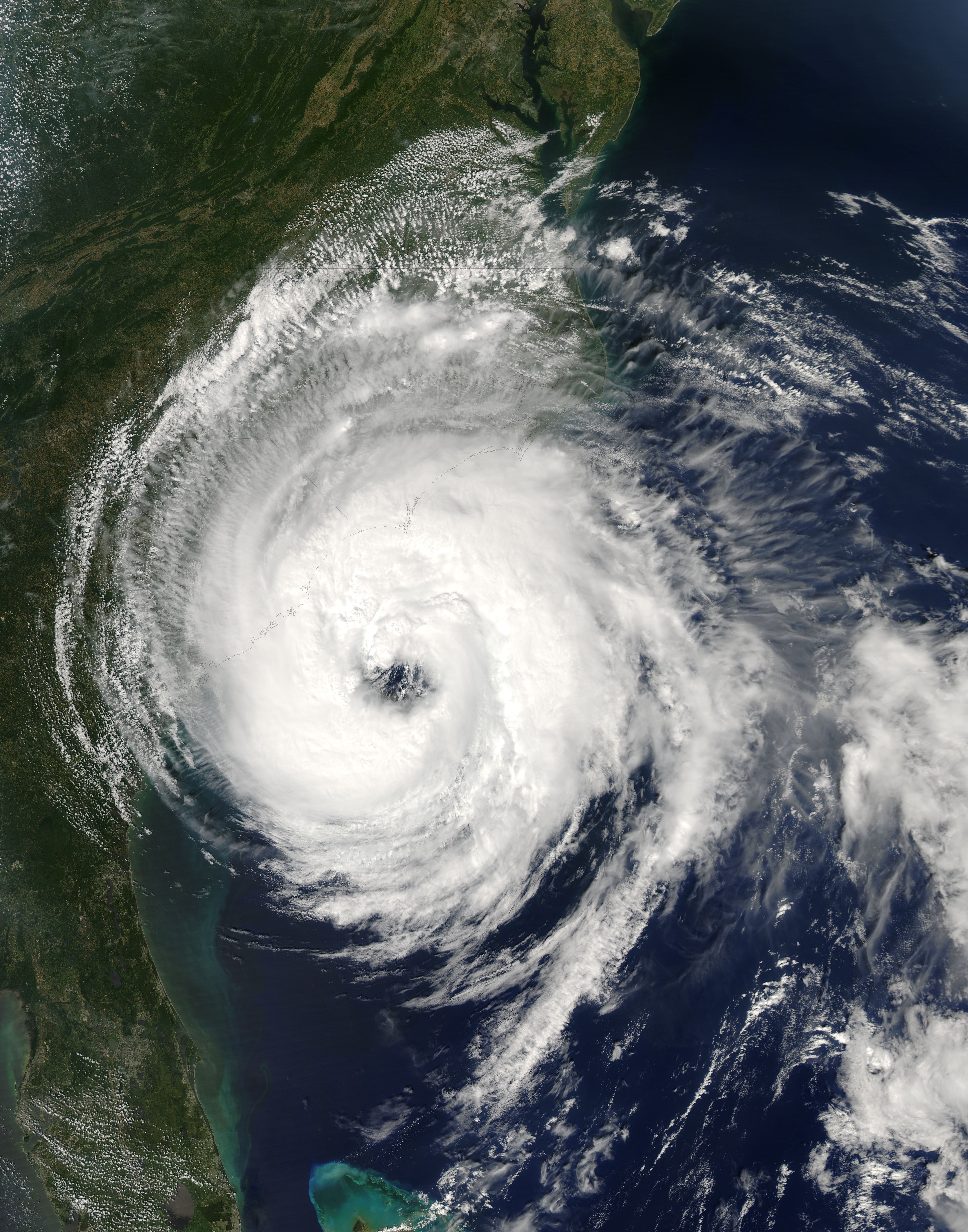
Hurricane Ophelia lived up to its name as it wound haphazardly north along the U.S. Eastern Seaboard during the second week of September 2005. The storm was a still two days away from making landfall when the Moderate Resolution Imaging Spectroradiometer (MODIS) on NASA’s Aqua satellite captured this image at 2:30 p.m. Eastern time on September 13, 2005. At the time, Ophelia had winds of 110 kilometers per hour (70 miles per hour) with stronger gusts. The slow-moving storm is forecast to dump heavy rain on the Outer Banks of North Carolina before turning out to sea on its northeastward course. The large image provided above has a resolution of 250 meters per pixel. The image is available in additional resolutions from the MODIS Rapid Response Team. |
|||||
| Date | ||||||
| Source | http://earthobservatory.nasa.gov/NaturalHazards/natural_hazards_v2.php3?img_id=13129 | |||||
| Author | NASA image courtesy Jeff Schmaltz, MODIS Land Rapid Response Team at NASA GSFC | |||||
| Permission (Reusing this file) |
|

File history
Click on a date/time to view the file as it appeared at that time.
| Date/Time | Thumbnail | Dimensions | User | Comment | |
|---|---|---|---|---|---|
| current | 20:49, 6 November 2006 | | 4,400 × 5,600 (4.4 MB) | Good kitty | == Summary == {{Information |Description=Hurricane Ophelia lived up to its name as it wound haphazardly north along the U.S. Eastern Seaboard during the second week of September 2005. The storm was a still two days away from making landfall when the Moder |
File usage
The following page uses this file:
Global file usage
The following other wikis use this file:
- Usage on eo.wikipedia.org
- Usage on es.wikipedia.org
- Usage on nl.wikipedia.org