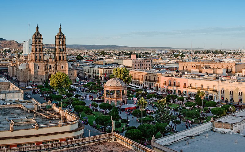
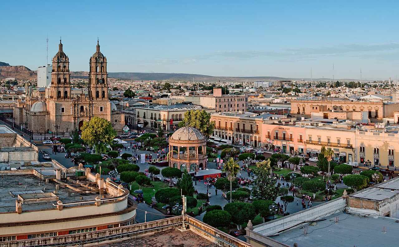
File:Panoramica plaza de armas Durango.jpg

Size of this preview: 800 × 496 pixels. Other resolutions: 320 × 198 pixels | 640 × 397 pixels | 1,024 × 635 pixels | 1,280 × 793 pixels | 2,560 × 1,587 pixels | 5,227 × 3,240 pixels.
Original file (5,227 × 3,240 pixels, file size: 3.57 MB, MIME type: image/jpeg)
| This is a file from the Wikimedia Commons. Information from its description page there is shown below. Commons is a freely licensed media file repository. You can help. |
Summary
| Description |
Čeština: Duraznské náměstí v Mexiku Español: Panoramica plaza de armas Durango |
| Date | |
| Source | https://www.britannica.com/place/Durango-Mexico |
| Author | Oliver Alexander Anderson Huerta from Durango, Mexico |
| Camera location | | View this and other nearby images on: OpenStreetMap |
|---|
Licensing
This file is licensed under the Creative Commons Attribution 2.0 Generic license.
- You are free:
- to share – to copy, distribute and transmit the work
- to remix – to adapt the work
- Under the following conditions:
- attribution – You must give appropriate credit, provide a link to the license, and indicate if changes were made. You may do so in any reasonable manner, but not in any way that suggests the licensor endorses you or your use.
This file, which was originally posted to
https://www.britannica.com/place/Durango-Mexico, was reviewed on 31 October 2017 by reviewer Jarekt, who confirmed that it was available there under the stated license on that date.
|
File history
Click on a date/time to view the file as it appeared at that time.
| Date/Time | Thumbnail | Dimensions | User | Comment | |
|---|---|---|---|---|---|
| current | 11:31, 25 April 2008 | | 5,227 × 3,240 (3.57 MB) | Sozi | {{Information |Description= |Source=[http://www.flickr.com/photos/50519036@N00/1904384034/ Panoramica plaza de armas Durango] |Date=November 03, 2007 at 17:54 |Author=[http://www.flickr.com/people/50519036@N00 Oliver Alexander Anderson Huerta] from Duran |
File usage
The following page uses this file:
Global file usage
The following other wikis use this file:
- Usage on ar.wikipedia.org
- Usage on ast.wikipedia.org
- Usage on be-tarask.wikipedia.org
- Usage on bg.wikipedia.org
- Usage on br.wikipedia.org
- Usage on ca.wikipedia.org
- Usage on ceb.wikipedia.org
- Usage on ckb.wikipedia.org
- Usage on cy.wikipedia.org
- Usage on de.wikipedia.org
- Usage on de.wikivoyage.org
- Usage on el.wikipedia.org
- Usage on en.wikipedia.org
- Municipalities of Durango
- Camino Real de Tierra Adentro
- List of World Heritage Sites in Mexico
- Durango Municipality
- Northern Mexico
- Wikipedia:Wikipedia Signpost/2019-02-28/Featured content
- Wikipedia:Wikipedia Signpost/Single/2019-02-28
- User:Jhenderson777/World cities map
- User:Dronebogus/Basement
- Wikipedia:Today's featured list/June 2022
- Wikipedia:Today's featured list/June 17, 2022
- Wikipedia:Main Page history/2022 June 17
- Wikipedia:Main Page history/2022 June 17b
- Usage on en.wikivoyage.org
- Usage on eo.wikipedia.org
- Usage on es.wikipedia.org
- Usage on et.wikipedia.org
- Usage on eu.wikipedia.org
- Usage on fa.wikipedia.org
- Usage on fi.wikipedia.org
- Usage on fr.wikipedia.org
- Usage on fr.wikivoyage.org
View more global usage of this file.