File:Red Line departing Sheridan Rd.jpg

Size of this preview: 800 × 499 pixels. Other resolutions: 320 × 200 pixels | 640 × 399 pixels | 1,024 × 639 pixels | 1,280 × 798 pixels | 3,007 × 1,875 pixels.
Original file (3,007 × 1,875 pixels, file size: 2.35 MB, MIME type: image/jpeg)
| This is a file from the Wikimedia Commons. Information from its description page there is shown below. Commons is a freely licensed media file repository. You can help. |
Summary
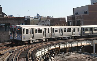
| Description | S curve, Chicago Elevated. 3940 North Sheridan Road. |
| Date | |
| Source | Red Line arriving at Sheridan Rd. |
| Author | Cragin Spring from Richmond Illinois, United States |
| Camera location | | View this and other nearby images on: OpenStreetMap |
|---|
Licensing
This file is licensed under the Creative Commons Attribution 2.0 Generic license.
- You are free:
- to share – to copy, distribute and transmit the work
- to remix – to adapt the work
- Under the following conditions:
- attribution – You must give appropriate credit, provide a link to the license, and indicate if changes were made. You may do so in any reasonable manner, but not in any way that suggests the licensor endorses you or your use.
| This image was originally posted to Flickr by Cragin Spring at https://flickr.com/photos/48922763@N04/21858769250. It was reviewed on 21 March 2016 by FlickreviewR and was confirmed to be licensed under the terms of the cc-by-2.0. |
File history
Click on a date/time to view the file as it appeared at that time.
| Date/Time | Thumbnail | Dimensions | User | Comment | |
|---|---|---|---|---|---|
| current | 14:45, 21 March 2016 | | 3,007 × 1,875 (2.35 MB) | Charterville | {{Information |Description=S curve, Chicago Elevated. 3940 North Sheridan Road. |Source=[https://www.flickr.com/photos/chiski/21858769250/ Red Line arriving at Sheridan Rd.] |Date=2015-10-07 13:20 |Author=[https://www.flickr.com/people/48922763@N04 Cra... |
File usage
The following page uses this file:
Global file usage
The following other wikis use this file:
- Usage on bn.wikipedia.org
- Usage on en.wikipedia.org
- Usage on es.wikipedia.org
- Usage on th.wikipedia.org