File:Rhineland-Palatinate location map.svg

Size of this PNG preview of this SVG file: 452 × 600 pixels. Other resolutions: 181 × 240 pixels | 362 × 480 pixels | 579 × 768 pixels | 772 × 1,024 pixels | 1,543 × 2,048 pixels | 930 × 1,234 pixels.
Original file (SVG file, nominally 930 × 1,234 pixels, file size: 677 KB)
| This is a file from the Wikimedia Commons. Information from its description page there is shown below. Commons is a freely licensed media file repository. You can help. |
Summary
| Description |
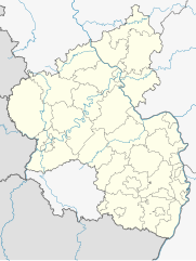
Deutsch: Positionskarte Rheinland-Pfalz, Deutschland. Geographische Begrenzung der Karte:
English: Location map Rhineland-Palatinate, Germany. Geographic limits of the map:
|
| Date | |
| Source |
own work, templates |
| Author | TUBS, versions later 2013-11: NordNordWest |
| Other versions |
Derivative works of this file: Location map of the scope of the Rhein-Main-Verkehrsverbund.svg
|


Licensing
I, the copyright holder of this work, hereby publish it under the following licenses:

|
Permission is granted to copy, distribute and/or modify this document under the terms of the GNU Free Documentation License, Version 1.2 or any later version published by the Free Software Foundation; with no Invariant Sections, no Front-Cover Texts, and no Back-Cover Texts. A copy of the license is included in the section entitled GNU Free Documentation License. |
This file is licensed under the Creative Commons Attribution-Share Alike 3.0 Unported, 2.5 Generic, 2.0 Generic and 1.0 Generic license.
- You are free:
- to share – to copy, distribute and transmit the work
- to remix – to adapt the work
- Under the following conditions:
- attribution – You must give appropriate credit, provide a link to the license, and indicate if changes were made. You may do so in any reasonable manner, but not in any way that suggests the licensor endorses you or your use.
- share alike – If you remix, transform, or build upon the material, you must distribute your contributions under the same or compatible license as the original.
You may select the license of your choice.
File history
Click on a date/time to view the file as it appeared at that time.
| Date/Time | Thumbnail | Dimensions | User | Comment | |
|---|---|---|---|---|---|
| current | 09:28, 1 July 2014 | | 930 × 1,234 (677 KB) | NordNordWest | upd |
| 21:02, 2 November 2013 |  | 930 × 1,234 (679 KB) | NordNordWest | upd | |
| 21:01, 2 November 2013 |  | 930 × 1,234 (679 KB) | NordNordWest | upd | |
| 09:53, 28 January 2009 |  | 708 × 913 (626 KB) | TUBS | {{Information |Description= |Source= |Date= |Author= |Permission= |other_versions= }} | |
| 00:44, 28 January 2009 |  | 708 × 913 (627 KB) | TUBS | == Summary == {{Information |Description= {{de|Positionskarte Rheinland-Pfalz, Deutschland. Geographische Begrenzung der Karte:}} {{en|Location map Rhineland-Palatinate, Germany. Geographic limits of |
File usage
The following 43 pages use this file:
- Aach, Rhineland-Palatinate
- Adenau
- Berndorf, Rhineland-Palatinate
- Bernkastel-Kues
- Bescheid
- Bingen am Rhein
- Bitburg
- Bremberg
- Börrstadt
- Cochem
- Damflos
- Detzem
- Eppelsheim
- Frankenthal
- Hermeskeil
- Hömberg
- Idar-Oberstein
- Kaiserslautern
- Koblenz
- Konz
- Landau
- Lorscheid
- Ludwigshafen
- Mainz
- Merzkirchen
- Montabaur
- Neustadt an der Weinstrasse
- Neuwied
- Oberbillig
- Pirmasens
- Remagen
- Schöndorf, Rhineland-Palatinate
- Speyer
- Tawern
- Temmels
- Trier
- Unkel
- Wellen, Rhineland-Palatinate
- Weyer, Germany
- Worms, Germany
- Zweibrücken
- Module:Location map/data/Germany Rhineland-Palatinate
- Module:Location map/data/Germany Rhineland-Palatinate/doc
Global file usage
The following other wikis use this file:
- Usage on ar.wikipedia.org
- Usage on azb.wikipedia.org
- Usage on ba.wikipedia.org
- Usage on bg.wikipedia.org
- Usage on ceb.wikipedia.org
- Usage on cs.wikipedia.org
- Usage on cv.wikipedia.org
- Usage on da.wikipedia.org
- Usage on de.wikipedia.org
- Benutzer:Soonix
- Flughafen Frankfurt-Hahn
- Heimbach-Weis
- Ramstein
- Johanniskreuz
- Mölschbach
- Wasserbilligerbrück
- Namedy
- Rengen
- Rieschweiler
- Dansenberg
- Büchelberg (Wörth)
- Bad Bodendorf
- Neubrücke (Nahe)
- Kirsch (Longuich)
- Hetzhof
- Petersbächel
- Winzenheim
- Flugplatz Zweibrücken
- Nitztal
- Fritz-Walter-Stadion
- Neumühle (Obernheim-Kirchenarnbach)
- Eifelpark
- Bruchwegstadion
- Bad Neuenahr
- Ahrweiler
- Bad Münster am Stein-Ebernburg
- Hisel
- Bosenheim
- Planig
- Theodor-Heuss-Brücke (A 6)
- Erfenbach
- Waldfischbach
- Prosterath
- Moselstadion
- Kripp
- Balduinbrücke
View more global usage of this file.