File:Satellite Loop of Hurricane Iota 11-16-2020.gif
Size of this preview: 600 × 600 pixels. Other resolutions: 240 × 240 pixels | 480 × 480 pixels | 1,000 × 1,000 pixels.
Original file (1,000 × 1,000 pixels, file size: 20.34 MB, MIME type: image/gif, looped, 50 frames, 4.9 s)
| This is a file from the Wikimedia Commons. Information from its description page there is shown below. Commons is a freely licensed media file repository. You can help. |
Summary
| Description |
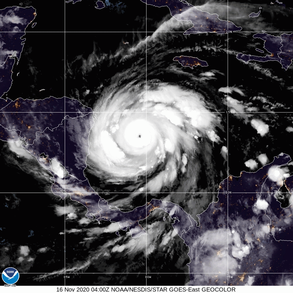
English: This satellite loop was taken early on Monday November 16, 2020 and it shows Hurricane Iota continue to rapidly intensify the storm's intensity at the time of the end of the satellite loop was (155 mph; 925 millibars) later that day Iota's pressure would drop another 8 millibars.
(Spanish:Este circuito satelital se tomó temprano el lunes 16 de noviembre de 2020 y muestra que el huracán Iota continúa intensificando rápidamente la intensidad de la tormenta en el momento en que el final del circuito satelital fue (155 mph; 925 milibares) más tarde ese día, la presión de Iota caería otro 8 milibares.) |
| Date | |
| Source | https://www.star.nesdis.noaa.gov |
| Author | NOAA |
Licensing
This image is in the public domain because it contains materials that originally came from the U.S. National Oceanic and Atmospheric Administration, taken or made as part of an employee's official duties.
|
File history
Click on a date/time to view the file as it appeared at that time.
| Date/Time | Thumbnail | Dimensions | User | Comment | |
|---|---|---|---|---|---|
| current | 13:04, 16 November 2020 | | 1,000 × 1,000 (20.34 MB) | TheWxResearcher | Uploaded a work by NOAA from https://www.star.nesdis.noaa.gov with UploadWizard |
File usage
The following 2 pages use this file:
Global file usage
The following other wikis use this file:
- Usage on ca.wikipedia.org
- Usage on en.wikipedia.org
- Usage on kw.wikipedia.org
- Usage on nl.wikipedia.org
- Usage on pt.wikipedia.org
- Usage on vi.wikipedia.org
- Usage on zh.wikipedia.org