File:Serranilla Bank marked satellite map.png

Original file (1,600 × 1,050 pixels, file size: 1.6 MB, MIME type: image/png)
| This is a file from the Wikimedia Commons. Information from its description page there is shown below. Commons is a freely licensed media file repository. You can help. |
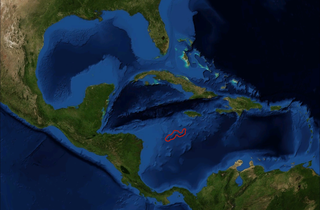
| Description | Satellite picture of Caribbean Sea with location of Serranilla Bank marked, from NASA World Wind Globe, version 1.4 |
| Date | (UTC) |
| Source | |
| Author |
|
| This is a retouched picture, which means that it has been digitally altered from its original version. Modifications: Marked location of Serranilla Bank. The original can be viewed here: Amerikanisches Mittelmeer NASA World Wind Globe .jpg:
|

|
This work is free software; you can redistribute it and/or modify it under the terms of the GNU General Public License as published by the Free Software Foundation; either version 2 of the License, or any later version. This work is distributed in the hope that it will be useful, but without any warranty; without even the implied warranty of merchantability or fitness for a particular purpose. See version 2 and version 3 of the GNU General Public License for more details. |
| This image is in the public domain because it is a screenshot from NASA’s globe software World Wind using a public domain layer, such as Blue Marble, MODIS, Landsat, SRTM, USGS or GLOBE.
|
 |
Original upload log
This image is a derivative work of the following images:
- File:Amerikanisches_Mittelmeer_NASA_World_Wind_Globe_.jpg licensed with GPL, PD-WorldWind
- 2008-06-22T16:30:28Z ILA-boy 1600x1050 (770588 Bytes) {{Information |Description=Satellite pictures, from NASA World Wind Globe, version 1.4 |Source=own work |Date=June 2008 |Author=[[User:ILA-boy|ILA-boy]] |Permission=GNU General Public License |other_versions= }} {{GPL}} [[C
Uploaded with derivativeFX
File history
Click on a date/time to view the file as it appeared at that time.
| Date/Time | Thumbnail | Dimensions | User | Comment | |
|---|---|---|---|---|---|
| current | 01:53, 31 May 2009 | | 1,600 × 1,050 (1.6 MB) | Nihonjoe | {{Information |Description=Satellite picture of Caribbean Sea with location of Serranilla Bank marked, from NASA World Wind Globe, version 1.4 |Source=*File:Amerikanisches_Mittelmeer_NASA_World_Wind_Globe_.jpg |Date=2009- |
File usage
The following page uses this file:
Global file usage
The following other wikis use this file:
- Usage on es.wikipedia.org
- Usage on fi.wikipedia.org
- Usage on id.wikipedia.org
- Usage on ja.wikipedia.org
- Usage on mk.wikipedia.org
- Usage on ml.wikipedia.org
- Usage on nl.wikipedia.org
- Usage on ru.wikipedia.org
- Usage on sv.wikipedia.org
- Usage on www.wikidata.org