File:Somali in Ethiopia.svg

Size of this PNG preview of this SVG file: 740 × 600 pixels. Other resolutions: 296 × 240 pixels | 592 × 480 pixels | 948 × 768 pixels | 1,263 × 1,024 pixels | 2,527 × 2,048 pixels | 1,843 × 1,494 pixels.
Original file (SVG file, nominally 1,843 × 1,494 pixels, file size: 495 KB)
| This is a file from the Wikimedia Commons. Information from its description page there is shown below. Commons is a freely licensed media file repository. You can help. |
Summary
| Description |
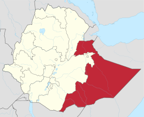
English: Somali Region location in Ethiopia |
| Date | |
| Source | SVG version of File:Somali Regional Map.png by User:AlaskaLava |
| Author |
PNG original: User:AlaskaLava SVG updated version: User:SUM1 |
Licensing
This file is licensed under the Creative Commons Attribution-Share Alike 4.0 International license.
- You are free:
- to share – to copy, distribute and transmit the work
- to remix – to adapt the work
- Under the following conditions:
- attribution – You must give appropriate credit, provide a link to the license, and indicate if changes were made. You may do so in any reasonable manner, but not in any way that suggests the licensor endorses you or your use.
- share alike – If you remix, transform, or build upon the material, you must distribute your contributions under the same or compatible license as the original.
File history
Click on a date/time to view the file as it appeared at that time.
| Date/Time | Thumbnail | Dimensions | User | Comment | |
|---|---|---|---|---|---|
| current | 13:37, 14 September 2023 | | 1,843 × 1,494 (495 KB) | HapHaxion | prepare for merge |
| 02:39, 30 December 2021 |  | 1,843 × 1,494 (428 KB) | Gebagebo | Fixed Somaliland border | |
| 14:47, 7 July 2021 |  | 1,843 × 1,494 (428 KB) | Jacob300 | Added dashed lines to show Somaliland. | |
| 23:28, 8 July 2017 |  | 1,843 × 1,494 (428 KB) | SUM1 | User created page with UploadWizard |
File usage
The following page uses this file:
Global file usage
The following other wikis use this file:
- Usage on als.wikipedia.org
- Usage on am.wikipedia.org
- Usage on ar.wikipedia.org
- Usage on bg.wikipedia.org
- Usage on ca.wikipedia.org
- Usage on cs.wikipedia.org
- Usage on da.wikipedia.org
- Usage on de.wikipedia.org
- Usage on el.wikipedia.org
- Usage on en.wikipedia.org
- Regions of Ethiopia
- Somali Region
- List of first-level administrative divisions by area
- Sitti Zone
- Fafan Zone
- Liben Zone
- Jijiga Gerad Wilwal Airport
- Raid on Abole oil exploration facility
- Insurgency in Ogaden
- List of active separatist movements in Africa
- User:Dabcasar/sandbox
- User:GerardM/Regions of Ethiopia
- List of governors of the regions of Ethiopia
- Talk:Somali Region/Archive 1
- List of Ethiopian flags
- Somalis in Ethiopia
- User:Treetoes023/List of the largest country subdivisions by area
- Aw-barre Refugee Camp
- Usage on en.wikinews.org
- Usage on eo.wikipedia.org
- Usage on es.wikipedia.org
- Usage on et.wikipedia.org
- Usage on fa.wikipedia.org
View more global usage of this file.