File:St-Thibery-Pont-Romain1.JPG

Size of this preview: 800 × 533 pixels. Other resolutions: 320 × 213 pixels | 640 × 427 pixels | 1,024 × 683 pixels | 1,280 × 853 pixels | 1,728 × 1,152 pixels.
Original file (1,728 × 1,152 pixels, file size: 708 KB, MIME type: image/jpeg)
| This is a file from the Wikimedia Commons. Information from its description page there is shown below. Commons is a freely licensed media file repository. You can help. |
Summary
|
This building is indexed in the base Mérimée, a database of architectural heritage maintained by the French Ministry of Culture, under the reference PA00103715
|
| Description |
Deutsch: Die Reste der Römerbrücke von Saint-Thibéry über den Fluß Hérault in Südfrankreich. Die Brücke gehörte zur Via Domitia.
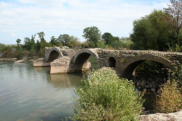
English: The remains of the Roman bridge of Saint-Thibéry across the river Hérault in Southern France. The bridge was part of the Via Domitia.
Français : Pont dit “Pont Romain” de Saint-Thibéry (Hérault), utilisé par la Voie Domitienne pour traverser l'Hérault. Probablement pont du Moyen-Âge. |
| Date | |
| Source | Transferred from fr.wikipedia to Commons. |
| Author | Fagairolles 34 at French Wikipedia |
| Camera location | | View this and other nearby images on: OpenStreetMap |
|---|
Licensing
I, the copyright holder of this work, hereby publish it under the following license:
This file is licensed under the Creative Commons Attribution-Share Alike 4.0 International license.
- You are free:
- to share – to copy, distribute and transmit the work
- to remix – to adapt the work
- Under the following conditions:
- attribution – You must give appropriate credit, provide a link to the license, and indicate if changes were made. You may do so in any reasonable manner, but not in any way that suggests the licensor endorses you or your use.
- share alike – If you remix, transform, or build upon the material, you must distribute your contributions under the same or compatible license as the original.
Original upload log
The original description page was here. All following user names refer to fr.wikipedia.
- 2006-10-12 07:09 Fagairolles 34 1728×1152×8 (725108 bytes) Pont Romain de St-Thibéry, utilisé par la Voie Domitienne pour traverser l'Hérault.
File history
Click on a date/time to view the file as it appeared at that time.
| Date/Time | Thumbnail | Dimensions | User | Comment | |
|---|---|---|---|---|---|
| current | 14:18, 19 November 2006 | | 1,728 × 1,152 (708 KB) | Fagairolles 34 | {{Information |Description=Pont Romain de St-Thibéry, utilisé par la Voie Domitienne pour traverser l'Hérault. Auteur : Fagairolles 34 Date : octobre 2006 {{PD |jour=12|mois=octobre|année=2006}} |Source=Originally from [http://fr.wikipedia.org fr.wi |
File usage
There are no pages that use this file.
Global file usage
The following other wikis use this file:
- Usage on arz.wikipedia.org
- Usage on bg.wikipedia.org
- Usage on br.wikipedia.org
- Usage on ca.wikipedia.org
- Usage on ceb.wikipedia.org
- Usage on da.wikipedia.org
- Usage on de.wikipedia.org
- Usage on el.wikipedia.org
- Usage on en.wikipedia.org
- Usage on eo.wikipedia.org
- Usage on es.wikipedia.org
- Usage on et.wikipedia.org
- Usage on eu.wikipedia.org
- Usage on fi.wikipedia.org
- Usage on fr.wikipedia.org
- Usage on it.wikipedia.org
- Usage on ja.wikipedia.org
- Usage on la.wikipedia.org
- Usage on mk.wikipedia.org
- Usage on ms.wikipedia.org
- Usage on no.wikipedia.org
View more global usage of this file.