File:TS Norman 09 oct 2006 1849Z.jpg
Size of this preview: 476 × 599 pixels. Other resolutions: 190 × 240 pixels | 381 × 480 pixels | 610 × 768 pixels | 813 × 1,024 pixels | 1,626 × 2,048 pixels | 5,400 × 6,800 pixels.
Original file (5,400 × 6,800 pixels, file size: 6.18 MB, MIME type: image/jpeg)
| This is a file from the Wikimedia Commons. Information from its description page there is shown below. Commons is a freely licensed media file repository. You can help. |
Summary
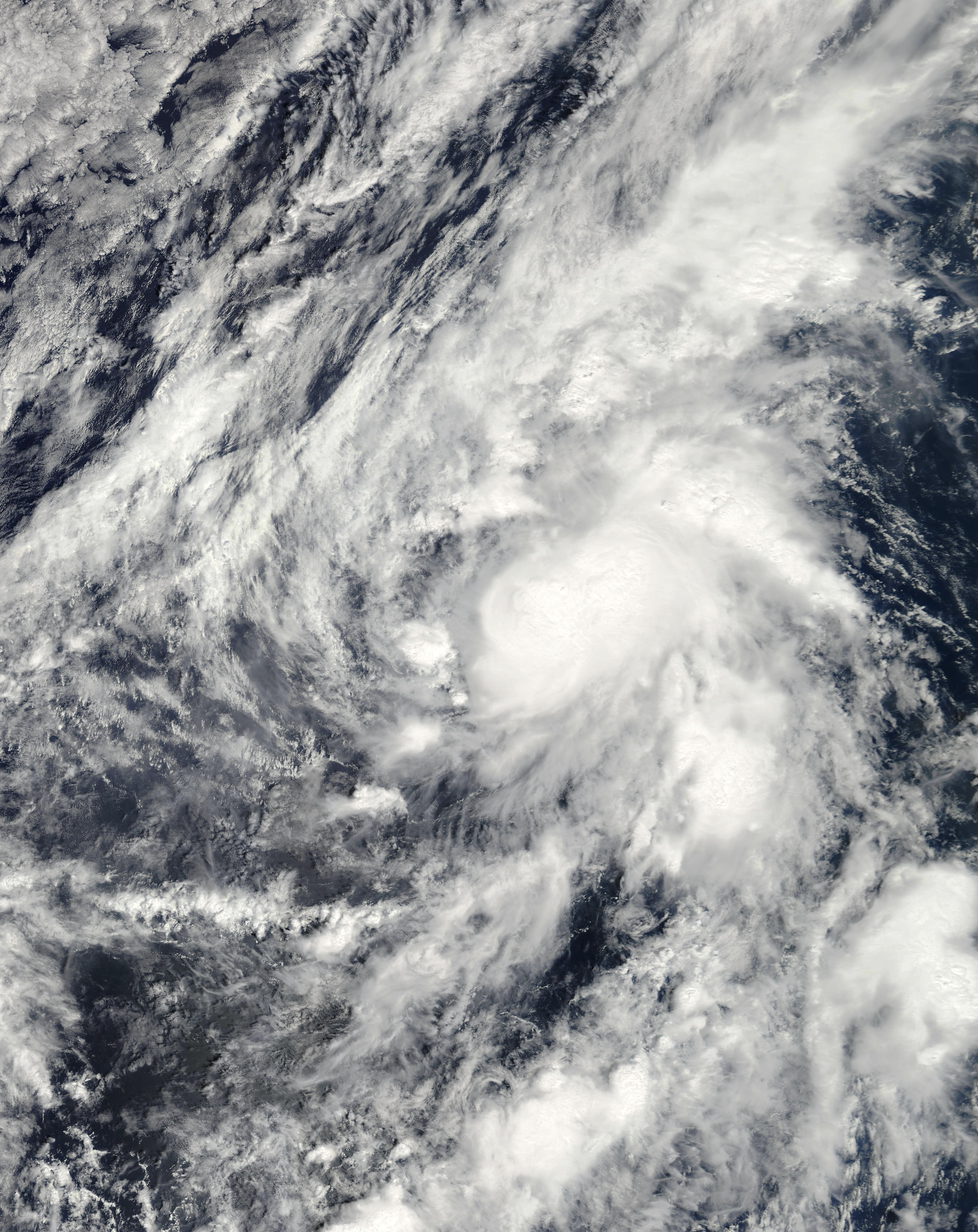
| Description | This image of Tropical Storm Norman was captured by the MODIS instrument on NASA's Terra satellite at 1849 UTC on October 9, 2006 when it was located in the eastern Pacific Ocean. At the time, maximum sustained winds were 45 mph and the minimum pressure was approximately 1002 mb. | ||||||
| Date | |||||||
| Source | http://www.nrlmry.navy.mil/tc_pages/tc_home.html | ||||||
| Author | Naval Research Laboratory | ||||||
| Permission (Reusing this file) |
|
||||||

File history
Click on a date/time to view the file as it appeared at that time.
| Date/Time | Thumbnail | Dimensions | User | Comment | |
|---|---|---|---|---|---|
| current | 19:12, 7 November 2020 | | 5,400 × 6,800 (6.18 MB) | FleurDeOdile | m |
| 20:45, 14 June 2019 |  | 4,401 × 4,401 (7.23 MB) | TheAustinMan | Soften cloud brightnesses | |
| 00:41, 21 May 2018 |  | 4,401 × 4,401 (1.8 MB) | CooperScience | True color | |
| 01:09, 11 October 2006 |  | 3,972 × 3,972 (2.19 MB) | Good kitty | == Summary == {{Information |Description=This image of Tropical Storm Norman was captured by the MODIS instrument on NASA's Terra satellite at 1849 UTC on October 9, 2006 when it was located in the eastern Pacific Ocean. At the time, maximum sustained win |
File usage
The following page uses this file:
Global file usage
The following other wikis use this file:
- Usage on de.wikipedia.org
- Usage on en.wikipedia.org
- Usage on es.wikipedia.org
- Usage on nl.wikipedia.org
- Usage on pt.wikipedia.org
- Usage on zh.wikipedia.org