File:USA 10187 Horseshoe Bend Luca Galuzzi 2007.jpg
Original file (2,000 × 1,333 pixels, file size: 2.4 MB, MIME type: image/jpeg)
| This is a file from the Wikimedia Commons. Information from its description page there is shown below. Commons is a freely licensed media file repository. You can help. |
Summary
| Description |
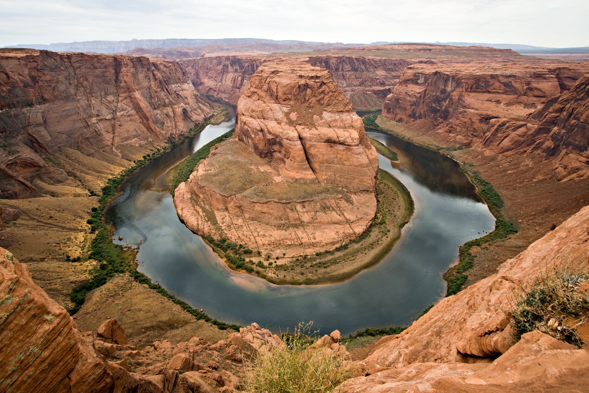
Deutsch: Horseshoe Bend eine hufeisen-förmige Flusswindung des Colorado Rivers in Arizona.
English: Horseshoe Bend, Arizona. Horseshoe Bend is a horseshoe-shaped meander of the Colorado River located near the town of Page, Arizona.
Français : Horseshoe Bend (« la courbe du fer à cheval ») est un méandre du fleuve Colorado situé à 6 km au sud de la ville de Page en Arizona aux États-Unis.
|
||
| Date | |||
| Source | Photo taken by (Luca Galuzzi) * http://www.galuzzi.it | ||
| Author | Luca Galuzzi (Lucag) | ||
| Permission (Reusing this file) |
I, Luca Galuzzi, the copyright holder of this work, hereby publishes it under the following license: This file is licensed under the Creative Commons Attribution-Share Alike 2.5 Generic license. Attribution: I, Luca Galuzzi
|

| Object location | | View this and other nearby images on: OpenStreetMap |
|---|
Assessment
|

This image was selected as picture of the day on Wikimedia Commons for 5 March 2011. It was captioned as follows: English: Horseshoe Bend, Arizona. Horseshoe Bend is a horseshoe-shaped meander of the Colorado River located near the town of Page, Arizona. Other languages:
Dansk: Horseshoe Bend er en hesteskoformet bugtning af Colorado River i nærheden af byen Page, Arizona. Deutsch: Der Horseshoe Bend ist eine hufeisenförmige Schleife des Colorado River nahe der Stadt Page in Arizona (USA) English: Horseshoe Bend, Arizona. Horseshoe Bend is a horseshoe-shaped meander of the Colorado River located near the town of Page, Arizona. Español: Curva de la Herradura, un meandro con forma de herradura del río Colorado ubicado cerca de la ciudad de Page (Arizona, EE.UU.) Français : Horseshoe Bend (« la courbe du fer à cheval ») est un méandre du fleuve Colorado situé à 6 km au sud de la ville de Page en Arizona aux États-Unis. Italiano: La Horseshoe Bend, un'ansa a forma di ferro di cavallo lungo il corso del fiume Colorado, nelle vicinanze della cittadina di Page, in Arizona. Nederlands: Horseshoe Bend in Arizona, een hoefijzervormige meander van de Coloradorivier. Deze meander is gelegen nabij de stad Page, in het noorden van Arizona. Українська: Вигин Підкови (Horseshoe Bend) — меандр (річковий вигин) річки Колорадо біля міста Пейдж, Аризона 日本語: アリゾナ州ペイジの町の近くにある、コロラド川の湾曲部「ホースシュー・ベンド」。その名の通り、川が蹄鉄の形に蛇行している。 |
File history
Click on a date/time to view the file as it appeared at that time.
| Date/Time | Thumbnail | Dimensions | User | Comment | |
|---|---|---|---|---|---|
| current | 21:37, 5 September 2007 | | 2,000 × 1,333 (2.4 MB) | Lucag | {{Information |Description=Horseshoe Bend, Arizona. Horseshoe Bend is a horseshoe-shaped meander of the Colorado River located near the town of Page, Arizona |Source=Photo taken by (Luca Galuzzi) * http://www.galuzzi.it |Date=2007-07-21 |
File usage
The following page uses this file:
Global file usage
The following other wikis use this file:
- Usage on ar.wikipedia.org
- Usage on azb.wikipedia.org
- Usage on az.wikipedia.org
- Usage on ba.wikipedia.org
- Usage on be-tarask.wikipedia.org
- Usage on be.wikipedia.org
- Usage on bn.wikipedia.org
- Usage on br.wikipedia.org
- Usage on crh.wikipedia.org
- Usage on cs.wikipedia.org
- Usage on cv.wikipedia.org
- Usage on de.wikipedia.org
- Usage on en.wikipedia.org
- Usage on es.wikipedia.org
- Usage on es.wikibooks.org
- Usage on et.wikipedia.org
- Usage on fa.wikipedia.org
- رودخانه کلرادو
- ویکیپدیا:نگارههای برگزیده/جاها/طبیعت
- ویکیپدیا:گزیدن نگاره برگزیده/ژوئن-۲۰۱۲
- درگاه:جغرافیا/نگارهٔ برگزیده
- درگاه:جغرافیا/نگارهٔ برگزیده/۱۸
- ویکیپدیا:نگارههای پیشنهادی/طبیعت
- ویکیپدیا:نگاره روز/سپتامبر ۲۰۱۲
- بحث کاربر:Mahan/بایگانی ۳
- ویکیپدیا:گزیدن نگاره برگزیده/USA 10187 Horseshoe Bend Luca Galuzzi 2007.jpg
- الگو:نر/2012-09-27
- الگو:نر محافظت شده/2012-09-27
- درگاه:ایالات متحده آمریکا/نگاره برگزیده
- درگاه:ایالات متحده آمریکا/نگاره برگزیده/۴۱
- Usage on fr.wikipedia.org
- Usage on he.wikipedia.org
- Usage on hu.wikipedia.org
- Usage on hy.wikipedia.org
- Usage on it.wikipedia.org
- Usage on kk.wikipedia.org
- Usage on ko.wikipedia.org
View more global usage of this file.