File:Verlaufskarte Ruhr2.png

Size of this preview: 800 × 419 pixels. Other resolutions: 320 × 168 pixels | 640 × 335 pixels | 1,024 × 537 pixels | 1,280 × 671 pixels | 2,000 × 1,048 pixels.
Original file (2,000 × 1,048 pixels, file size: 2.6 MB, MIME type: image/png)
| This is a file from the Wikimedia Commons. Information from its description page there is shown below. Commons is a freely licensed media file repository. You can help. |
Summary
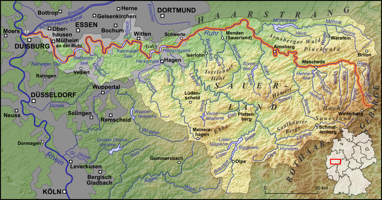
| Description | Die Ruhr und ihre Nebenflüsse |
| Date | |
| Source |
own work, used:
|
| Author | Lencer |

|
This map has been made or improved in the German Kartenwerkstatt (Map Lab). You can propose maps to improve as well.
|
Licensing
I, the copyright holder of this work, hereby publish it under the following license:
This file is licensed under the Creative Commons Attribution-Share Alike 3.0 Unported license.
- You are free:
- to share – to copy, distribute and transmit the work
- to remix – to adapt the work
- Under the following conditions:
- attribution – You must give appropriate credit, provide a link to the license, and indicate if changes were made. You may do so in any reasonable manner, but not in any way that suggests the licensor endorses you or your use.
- share alike – If you remix, transform, or build upon the material, you must distribute your contributions under the same or compatible license as the original.
File history
Click on a date/time to view the file as it appeared at that time.
| Date/Time | Thumbnail | Dimensions | User | Comment | |
|---|---|---|---|---|---|
| current | 05:51, 20 October 2011 | | 2,000 × 1,048 (2.6 MB) | Lencer | fix |
| 05:38, 20 October 2011 |  | 2,000 × 1,048 (2.6 MB) | Lencer | Versetalsperre korrigiert | |
| 11:50, 19 October 2011 |  | 2,000 × 1,048 (2.6 MB) | Lencer | Stadtgebiete vergessen | |
| 05:37, 19 October 2011 |  | 2,000 × 1,048 (2.86 MB) | Lencer | some fixes | |
| 13:07, 18 October 2011 |  | 2,000 × 1,048 (2.85 MB) | Lencer | complete reworked and extended | |
| 14:54, 17 November 2008 |  | 1,500 × 786 (2.03 MB) | Lencer | {{Information |Description= |Source= |Date= |Author= |Permission= |other_versions= }} | |
| 17:25, 30 June 2008 |  | 1,500 × 786 (2.03 MB) | Lencer | {{Information |Description= |Source= |Date= |Author= |Permission= |other_versions= }} | |
| 15:21, 27 June 2008 |  | 1,500 × 786 (2.02 MB) | Lencer | == Beschreibung == {{Information |Description=Die Ruhr und ihre Nebenflüsse |Source=own work, used: * http://www.openstreetmap.org * [http://www2.demis.nl/wms/mapclip.htm Demis Webserver] * Generic Mapping Tools |Date=Juni 2008 |Author=[[Use |
File usage
The following page uses this file:
Global file usage
The following other wikis use this file:
- Usage on ar.wikipedia.org
- Usage on bg.wikipedia.org
- Usage on br.wikipedia.org
- Usage on ca.wikipedia.org
- Usage on ckb.wikipedia.org
- Usage on cs.wikipedia.org
- Usage on da.wikipedia.org
- Usage on de.wikipedia.org
- Usage on de.wikivoyage.org
- Usage on el.wikipedia.org
- Usage on en.wikipedia.org
- Usage on eo.wikipedia.org
- Usage on es.wikipedia.org
- Usage on fr.wikipedia.org
- Usage on fy.wikipedia.org
- Usage on he.wikipedia.org
- Usage on hr.wikipedia.org
- Usage on hsb.wikipedia.org
- Usage on hu.wikipedia.org
- Usage on ko.wikipedia.org
- Usage on ku.wikipedia.org
- Usage on ky.wikipedia.org
- Usage on lld.wikipedia.org
- Usage on lt.wikipedia.org
- Usage on mk.wikipedia.org
- Usage on nl.wikipedia.org
- Usage on no.wikipedia.org
- Usage on pa.wikipedia.org
- Usage on tr.wikipedia.org
- Usage on uk.wikipedia.org
- Usage on www.wikidata.org