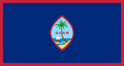
Guam
Guam (Chamorro: Guåhan) is an island in Micronesia in the Pacific Ocean and is a U.S. territory.[1] This means that it is part of the United States and citizens of Guam are citizens of the United States as well. Guam is not an independent country, but like all populated U.S. territories, it enjoys a greater degree of autonomy than U.S. states. The Chamorro people are the native people from Guam. The capital city of Guam is the city of Hagåtña and the largest city is Dededo. Guam has important United States Air Force and Naval bases, which occupy a major part of Guam's land area. Guam is also a popular tourist destination.


Guam is one of two U.S. territories where the metric system is officially used and is dominant. (The other is Puerto Rico, which was also a Spanish colony. The metric system was introduced to both territories, before they became U.S. territories.)[2]
History change
Guam was one of the first islands in the Pacific Ocean to be visited by the Europeans. In 1521, while leading the Spanish expedition, Ferdinand Magellan became one of the first Europeans to set foot on Guam. From then on, Guam became an important part of the trade route followed by the Spanish trading ships called Manila Galleon, which sailed between Mexico and the Philippines every year. And in 1668, Spain took over Guam as one of its territories. During this time, the natives assimilated the Spanish culture to a large extent.
In the 1898, Spanish–American War, Spain lost most of its territories to the United States under the Treaty of Paris, including Guam, Cuba, the Philippines, and Puerto Rico. Guam continued to be important due to its strategic location for shipping, and later for air travel in the Pacific. During World War II, Japan occupied Guam in 1941 for 31 months, but lost the territory to the United States soon after. The Chamorro people are spread across Guam and Northern Mariana Islands- which is also a United States territory. However, the Chamorro people from Northern Mariana Islands have not integrated well into the territory as they were under Japanese occupation for about 30 years.
In 1950, the United States Congress passed a law to incorporate the people of Guam as American citizens.
In August 2017, North Korea warned that it might launch mid-range ballistic missiles into waters within 18 to 24 miles (29 to 38 kilometers) of Guam, following an exchange of threats[3][4] between the governments of North Korea and the United States.
Money change
The currency of Guam is the United States dollar. Guam gets most of its money from the United States government. Much of that money is spent on the military bases, but there are also federal grants given to the Guam government for various programs. Because it is only a territory, federal income taxes paid by Guam residents are given to the Guam government for its operations.
Guam is a sought after travel destination. Almost all of these visitors are from Japan. Japanese tourists like Guam because it is closer to Japan than other American places. Guam has lots of hotels and other fun places for people to visit. Tumon Bay is Guam's biggest beach. It has lots of pretty white sand, and the water has lots of fish. Tumon is becoming a busy city.
The number of visitors to Guam has decreased significantly mainly because of economic slowdown in most parts of Asia, which is also the cause for lost jobs in Guam.
Land and water change
Guam is 212 square miles (549 square kilometers) large. In the north part, it has a flat area of coral and limestone rock. The south part has mountains. Around the island is a coral reef.
Guam is next to the Marianas Trench, which is the deepest part of the Earth and underwater. It sometimes has earthquakes, some of which have been very strong.
Guam is a tropical island. It is usually quite warm and wet and the temperature does not change very much. From February to July it is dry, but the rest of the year it is rainy. Sometimes Guam has very strong and dangerous storms in October and November.
References change
- ↑ More exactly, it is an unincorporated territory.
- ↑ "US leaves the world puzzled by dragging its feet on metric system". The Nation Thailand. 2015-12-26. Retrieved 2023-01-28.
- ↑ Horton, Alex (August 9, 2017). "Why North Korea threatened Guam, the tiny U.S. territory with big military power". The Washington Post.
- ↑ Daniels, Jeff (10 August 2017). "North Korea's missile threat to Guam crafted for 'maximum drama,' says former CIA analyst". CNBC News. Retrieved 11 August 2017.
Other websites change
- Guampedia, Guam's Online Encyclopedia
- The Insular Empire: America in the Mariana Islands, PBS documentary film & website
- Official Portal for the Island of Guam
- "Guam". The World Factbook (2024 ed.). Central Intelligence Agency.
- U.S. Census Bureau: Island Areas Census 2000
- Guam at the Open Directory Project
- Portals to the World: Guam from the U.S. Library of Congress
- Wikimedia Atlas of Guam
- KUAM TV/AM/FM
- War in the Pacific – Liberation of Guam
- Guam travel guide from Wikivoyage
- Maps – Perry-Castañeda Library Map Collection
- Military: Naval Air Station, Agana (Tiyan) (closed). GlobalSecurity.org. Retrieved 2010-02-19.
- Goetzfridt, Nicholas J. (2011) Guahan: A Bibliographic History. Honolulu: University of Hawai'i Press Archived 2011-05-11 at the Wayback Machine
- NOAA's National Weather Service - Guam
- Guam -Citizendium