Aude (river)
The Aude is a river of southern French. It starts in the Pyrénées mountains and ends in the Mediterranean Sea. The Aude department is named after this river.
| Aude L'Aude | |
|---|---|
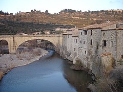
 The Aude at Carcassonne | |
.png) The Aude river (blue lines) in the Aude department (with red lines) | |
| Location | |
| Countries | France |
| Physical characteristics | |
| Source | |
| - location | Les Angles, Lac d'Aude, Massif du Carlit, Pyrénées, France |
| - elevation | 2,136 m (7,008 ft) |
| Mouth | |
| - location | Fleury/Vendres, France, Mediterranean Sea |
| - coordinates | 43°12′45″N 3°14′25″E / 43.21250°N 3.24028°E |
| - elevation | 0 m (0 ft) |
| Length | 224.1 km (139.2 mi)[1] |
| Basin size | 6,074 square kilometres (2,345 sq mi) total and 4,900 square kilometres (1,900 sq mi) above Coursan[3] |
| Discharge | |
| - average | 43.6 m3/s (1,540 cu ft/s) at Moussan[2] |
| Basin features | |
| Tributaries | |
| - left | the Cesse, the Fresquel, the Orbiel, the Argent-Double, the Trapel, the Sou de Val de Daigne |
| - right | the Orbieu, the Sals, the Lauquet |
In Roman times, the Aude was called Atax by the Romans. In all likelihood the current name comes from gradual changes of Atax, a word borrowed from the Celtic atacos meaning "spirited" or "very fast"[4]
Geography change
The Aude has a length of 224 km (139.2 mi), and a drainage basin with an area of approximately 6,074 km2 (2,345 sq mi).[5]
Its average yearly discharge (volume of water which passes through a section of the river per unit of time) is 41.40 cubic metres per second at Moussan.[6]
Course change
The Aude starts in the Massif of Carlit at the Lac d'Aude at an elevation of 2,180 metres (7,150 ft) in the commune of Les Angles (Pyrénées-Orientales department).[7]
From the Pyrénées to Carcassonne, the river flows generally from south to north and then turns to the east. The river then flows into the Mediterranean Sea a few kilometres from Narbonne at Grau de Vendres (near Cabanes-de-Fleury) on the border between the departments of Aude and Hérault.[8]
The Aude flows through 1 region, 4 departments and 75 communes.[5] The main communes are:
Main tributaries change
The main tributaries (30 km or more long) of the Aude river are:
Gallery change
-
 The Aude at Matemale
 -
 The Aude at Axat
 -
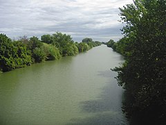 The Aude near its mouth at Salles-d'Aude
 -


Related pages change
References change
- ↑ The Aude Archived 2013-06-10 at the Wayback Machine, Sandre, consulted on 17 February 2013 (in French)
- ↑ Hydro Bank - The Aude at Moussan (1965-2009) Archived 2021-11-22 at the Wayback Machine, Ministry of Ecology, Sustainable Development and Energy, consulted on 17 February 2013 (in French)
- ↑ Hydro Bank - The Aude at Coursan Archived 2021-11-22 at the Wayback Machine, Ministry of Ecology, Sustainable Development and Energy, consulted on 17 February 2013 (in French)
- ↑ "Atacos / Atax / Attagus (Aude)" (in French). L'arbre celtique. Retrieved 20 July 2015.
- ↑ 5.0 5.1 "L'Aude (Y1--0200)" (in French). SANDRE - Portail national d'accès aux référentiels sur l'eau. Archived from the original on 10 June 2013. Retrieved 20 July 2015.
- ↑ "L'Aude à Moussan" (in French). Banque Hydro. Archived from the original on 22 November 2021. Retrieved 20 July 2015.
- ↑ "Source de l'Aude" (in French). Géoportail. Retrieved 20 July 2015.
- ↑ "Confluence de l'Aude" (in French). Géoportail. Retrieved 20 July 2015.
- ↑ "Le Rebenty (Y1100500)" (in French). SANDRE - Portail national d'accès aux référentiels sur l'eau. Archived from the original on 4 March 2016. Retrieved 20 July 2015.
- ↑ "Le Sou (Y1200500)" (in French). SANDRE - Portail national d'accès aux référentiels sur l'eau. Archived from the original on 4 March 2016. Retrieved 20 July 2015.
- ↑ "Le Fresquel (Y13-0400)" (in French). SANDRE - Portail national d'accès aux référentiels sur l'eau. Archived from the original on 3 March 2016. Retrieved 20 July 2015.
- ↑ "L'Orbiel (Y1410500)" (in French). SANDRE - Portail national d'accès aux référentiels sur l'eau. Archived from the original on 1 July 2013. Retrieved 20 July 2015.
- ↑ "L'Argent-Double (Y1430540)" (in French). SANDRE - Portail national d'accès aux référentiels sur l'eau. Archived from the original on 3 March 2016. Retrieved 20 July 2015.
- ↑ "La Cesse (Y1600500)" (in French). SANDRE - Portail national d'accès aux référentiels sur l'eau. Archived from the original on 3 March 2016. Retrieved 20 July 2015.
- ↑ "Le Lauquet (Y1220500)" (in French). SANDRE - Portail national d'accès aux référentiels sur l'eau. Archived from the original on 3 March 2016. Retrieved 20 July 2015.
- ↑ "L'Orbieu (Y15-0400)" (in French). SANDRE - Portail national d'accès aux référentiels sur l'eau. Archived from the original on 3 March 2016. Retrieved 20 July 2015.
Other websites change
- Banque Hydro - Station Y1612020 - L'Aude à Moussan Archived 2015-02-19 at the Wayback Machine (in French)