Alpes–Isère Airport
airport
Alpes–Isère Airport (formerly known as Grenoble-Isère Airport) (IATA: GNB, ICAO: LFLS), is an airport serving Grenoble. It is 2.5 km north-northwest of Saint-Étienne-de-Saint-Geoirs[1] and 40 km northwest of Grenoble. Both are communes in the Isère, département of France. It is also known as Grenoble - Saint-Geoirs Airport. The name, Isere, refers to the department of Isère.
Alpes–Isère Airport Aéroport Alpes–Isère
d'Exploitation de l'Aéroport de Grenoble (SEAG) | |||||||||||||||
|---|---|---|---|---|---|---|---|---|---|---|---|---|---|---|---|
| Summary | |||||||||||||||
| Serves | Grenoble, France | ||||||||||||||
| Location | Saint-Étienne-de-Saint-Geoirs | ||||||||||||||
| Elevation AMSL | 1,302 ft / 397 m | ||||||||||||||
| Coordinates | 45°21′47″N 005°19′46″E / 45.36306°N 5.32944°E | ||||||||||||||
| Website | grenoble-airport.com | ||||||||||||||
| Maps | |||||||||||||||
 Location of Rhône-Alpes region in France | |||||||||||||||
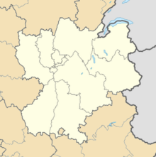
Location of airport in Rhône-Alpes region | |||||||||||||||
| Runways | |||||||||||||||
| |||||||||||||||
| Statistics (2014) | |||||||||||||||
| |||||||||||||||
Source: French AIP[1] | |||||||||||||||
A campus of the École nationale de l'aviation civile (French civil aviation university) is also at the airport.[2]
References
change- ↑ 1.0 1.1 LFLS – GRENOBLE SAINT-GEOIRS. AIP from French Service d'information aéronautique, effective 28 November 2024.
- ↑ (in French)Grenoble Archived 2012-05-05 at the Wayback Machine
