File:APY LGA.png
No higher resolution available.
APY_LGA.png (400 × 456 pixels, file size: 30 KB, MIME type: image/png)
| This is a file from the Wikimedia Commons. Information from its description page there is shown below. Commons is a freely licensed media file repository. You can help. |
Summary
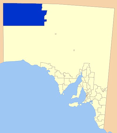
| Description | Map of South Australia showing the location of the APY Local Government Area. A modification of GDFL map by Astrokey44; found here: File:SA_LGA_blank.png |
| Source | Own work |
| Author | Kare Kare |
Licensing
| I, the copyright holder of this work, release this work into the public domain. This applies worldwide. In some countries this may not be legally possible; if so: I grant anyone the right to use this work for any purpose, without any conditions, unless such conditions are required by law. |
File history
Click on a date/time to view the file as it appeared at that time.
| Date/Time | Thumbnail | Dimensions | User | Comment | |
|---|---|---|---|---|---|
| current | 05:40, 23 July 2007 | | 400 × 456 (30 KB) | Kare Kare~commonswiki | {{Information |Description= Map of South Australia showing the location of the APY Local Government Area. A modification of GDFL map by Astrokey44; found here: http://commons.wikimedia.org/wiki/Image:SA_LGA_blank.png |Source=self-made |Date= |Author= [[Us |
File usage
The following page uses this file:
Global file usage
The following other wikis use this file:
- Usage on de.wikipedia.org
- Usage on en.wikipedia.org
- Usage on es.wikipedia.org
- Usage on fa.wikipedia.org
- Usage on fr.wikipedia.org
- Usage on it.wikipedia.org
- Usage on nl.wikipedia.org
- Usage on pt.wikipedia.org
- Usage on www.wikidata.org