File:Atlas (Gebirge).png

Size of this preview: 800 × 497 pixels. Other resolutions: 320 × 199 pixels | 640 × 397 pixels | 1,024 × 636 pixels | 1,280 × 795 pixels | 3,261 × 2,025 pixels.
Original file (3,261 × 2,025 pixels, file size: 11.8 MB, MIME type: image/png)
| This is a file from the Wikimedia Commons. Information from its description page there is shown below. Commons is a freely licensed media file repository. You can help. |
.png)
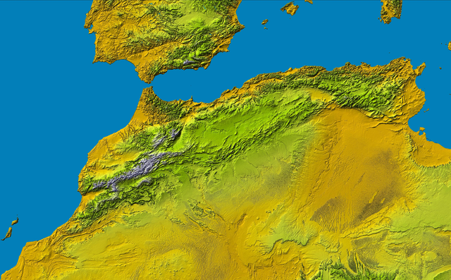
Atlas (Gebirge) a Part of: PIA04965: SRTM Data Release for Africa, Colored Height
Source: http://photojournal.jpl.nasa.gov/catalog/PIA04965
| This file is in the public domain in the United States because it was solely created by NASA. NASA copyright policy states that "NASA material is not protected by copyright unless noted". (See Template:PD-USGov, NASA copyright policy page or JPL Image Use Policy.) | ||
 |
Warnings:
|
This image uses high-resolution digital topography data from NASA's Shuttle Radar Topography Mission (SRTM) at JPL-Caltech [4]. It is in the public domain in the United States.
|
 | |
File history
Click on a date/time to view the file as it appeared at that time.
| Date/Time | Thumbnail | Dimensions | User | Comment | |
|---|---|---|---|---|---|
| current | 16:16, 16 May 2005 | | 3,261 × 2,025 (11.8 MB) | Atamari | Atlas (Gebirge) a Part of: PIA04965: SRTM Data Release for Africa, Colored Height Source: http://photojournal.jpl.nasa.gov/catalog/PIA04965 {{GFDL}}{{SpaceShuttle}} Category:Morocco\ |
| 03:15, 16 May 2005 |  | 806 × 411 (687 KB) | Atamari | Atlas (Gebirge) a Part of: PIA04965: SRTM Data Release for Africa, Colored Height Source: http://photojournal.jpl.nasa.gov/catalog/PIA04965 {{GFDL}}{{SpaceShuttle}} Category:Morocco\ |
File usage
There are no pages that use this file.
Global file usage
The following other wikis use this file:
- Usage on da.wikipedia.org
- Usage on de.wikipedia.org
- Usage on is.wikipedia.org
- Usage on it.wikipedia.org
- Usage on ja.wikipedia.org
- Usage on no.wikipedia.org
- Usage on ru.wikipedia.org
- Usage on tr.wikipedia.org
- Usage on uk.wikipedia.org
- Usage on uz.wikipedia.org
.png)