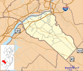
File:Location map of Gloucester County, New Jersey.svg

Size of this PNG preview of this SVG file: 700 × 600 pixels. Other resolutions: 280 × 240 pixels | 560 × 480 pixels | 896 × 768 pixels | 1,195 × 1,024 pixels | 2,389 × 2,048 pixels.
Original file (SVG file, nominally 896 × 768 pixels, file size: 1.14 MB)
File history
Click on a date/time to view the file as it appeared at that time.
| Date/Time | Thumbnail | Dimensions | User | Comment | |
|---|---|---|---|---|---|
| current | 15:27, 6 October 2012 |  | 896 × 768 (1.14 MB) | Omnedon | == {{int:filedesc}} == {{Information |Description={{en|This is a map of Gloucester County, New Jersey, USA which includes incorporated settlements, township borders, and major highways.}} |Source=My own work, using ... |
File usage
The following 3 pages use this file:
Global file usage
The following other wikis use this file:
- Usage on ar.wikipedia.org
- Usage on azb.wikipedia.org
- Usage on ceb.wikipedia.org
- Usage on en.wikipedia.org
- Beckett, New Jersey
- Clayton, New Jersey
- Deptford Township, New Jersey
- East Greenwich Township, New Jersey
- Elk Township, New Jersey
- Franklin Township, Gloucester County, New Jersey
- Gibbstown, New Jersey
- Glassboro, New Jersey
- Greenwich Township, Gloucester County, New Jersey
- Harrison Township, New Jersey
- Logan Township, New Jersey
- Mantua Township, New Jersey
- Monroe Township, Gloucester County, New Jersey
- Mullica Hill, New Jersey
- National Park, New Jersey
- Newfield, New Jersey
- Oak Valley, New Jersey
- Paulsboro, New Jersey
- Pitman, New Jersey
- South Harrison Township, New Jersey
- Swedesboro, New Jersey
- Turnersville, New Jersey
- Victory Lakes, New Jersey
- Washington Township, Gloucester County, New Jersey
- Wenonah, New Jersey
- West Deptford Township, New Jersey
- Westville, New Jersey
- Williamstown, New Jersey
- Woodbury, New Jersey
- Woodbury Heights, New Jersey
- Woolwich Township, New Jersey
View more global usage of this file.