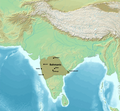
File:Map of the Bahmani Sultanate.png

Size of this preview: 648 × 600 pixels. Other resolutions: 259 × 240 pixels | 519 × 480 pixels | 830 × 768 pixels | 1,106 × 1,024 pixels | 2,324 × 2,151 pixels.
Original file (2,324 × 2,151 pixels, file size: 7.43 MB, MIME type: image/png)
File history
Click on a date/time to view the file as it appeared at that time.
| Date/Time | Thumbnail | Dimensions | User | Comment | |
|---|---|---|---|---|---|
| current | 06:36, 8 August 2024 |  | 2,324 × 2,151 (7.43 MB) | पाटलिपुत्र | Reverted to version as of 04:40, 8 August 2024 (UTC) Per Schwartzberg |
| 05:21, 8 August 2024 |  | 2,324 × 2,151 (7.38 MB) | Noorullah21 | Reverted to version as of 18:54, 7 August 2024 (UTC) -- The map doesn't say they were subordinate..they were tributaries, that was labeled beneath the Vijayanagara label. | |
| 04:40, 8 August 2024 |  | 2,324 × 2,151 (7.43 MB) | Flemmish Nietzsche | The Bahmanis had no authority over Vijayanagara, who was not subordinate despite paying tributary payments; to say they were and paint all of South India as Bahmani territory is heavily misleading. | |
| 18:54, 7 August 2024 |  | 2,324 × 2,151 (7.38 MB) | Noorullah21 | Added Vijayangara Tributary | |
| 02:38, 12 September 2023 |  | 2,324 × 2,151 (7.43 MB) | Noorullah21 | Uploaded a work by Map created from [http://www2.demis.nl/mapserver/mapper.asp DEMIS Mapserver], which are public domain. Koba-chan.<br> Reference: [https://dsal.uchicago.edu/reference/schwartzberg/pager.html?object=185] from {{extracted from|File:South Asia non political, with rivers.jpg}} with UploadWizard |
File usage
The following page uses this file:
Global file usage
The following other wikis use this file:
- Usage on bn.wikipedia.org
- Usage on en.wikipedia.org
