File:Ontario 400 map.svg

Size of this PNG preview of this SVG file: 512 × 395 pixels. Other resolutions: 311 × 240 pixels | 622 × 480 pixels | 996 × 768 pixels | 1,280 × 988 pixels | 2,560 × 1,975 pixels.
Original file (SVG file, nominally 512 × 395 pixels, file size: 361 KB)
| This is a file from the Wikimedia Commons. Information from its description page there is shown below. Commons is a freely licensed media file repository. You can help. |
Summary
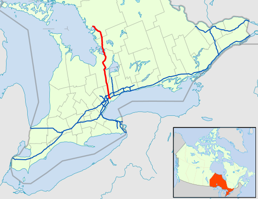
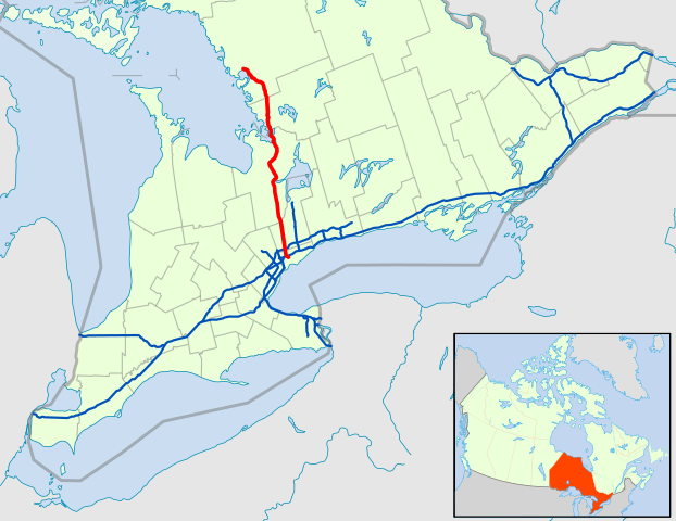
| Description | A map of Ontario's 400-series freeways, with Provincial Highway 400 in red. |
| Date | (UTC) |
| Source | modified from File:Canada_Ontario_location_map.svg |
| Author | Floydian (talk) |
Licensing
This file is licensed under the Creative Commons Attribution-Share Alike 3.0 Unported license.
- You are free:
- to share – to copy, distribute and transmit the work
- to remix – to adapt the work
- Under the following conditions:
- attribution – You must give appropriate credit, provide a link to the license, and indicate if changes were made. You may do so in any reasonable manner, but not in any way that suggests the licensor endorses you or your use.
- share alike – If you remix, transform, or build upon the material, you must distribute your contributions under the same or compatible license as the original.
File history
Click on a date/time to view the file as it appeared at that time.
| Date/Time | Thumbnail | Dimensions | User | Comment | |
|---|---|---|---|---|---|
| current | 00:43, 24 February 2021 | | 512 × 395 (361 KB) | Floydian | zoom in |
| 21:52, 23 February 2021 |  | 512 × 389 (360 KB) | Floydian | I lied. Fix whitespace around border | |
| 21:10, 23 February 2021 |  | 512 × 391 (266 KB) | Floydian | last one, I promise | |
| 20:28, 23 February 2021 |  | 512 × 391 (260 KB) | Floydian | think this should do it | |
| 19:55, 23 February 2021 |  | 512 × 391 (275 KB) | Floydian | add locator map | |
| 18:51, 23 February 2021 |  | 512 × 391 (213 KB) | Floydian | update to 2021 | |
| 22:13, 25 May 2010 |  | 900 × 750 (576 KB) | Floydian | ||
| 03:13, 3 March 2010 |  | 1,060 × 810 (653 KB) | Floydian | {{Information |Description=A map of Ontario's 400-series freeways, with Provincial Highway 400 in orange. |Source=modified from File:Canada_Ontario_location_map.svg |Date=~~~~~ |Author=~~~ |Permission= |other_versions= }} [[Category:Maps of Ontario H |
File usage
The following page uses this file:
Global file usage
The following other wikis use this file:
- Usage on de.wikipedia.org
- Usage on fa.wikipedia.org
- Usage on www.wikidata.org
- Usage on zh.wikipedia.org