File:Oosterland Wieringen.jpg

Size of this preview: 800 × 533 pixels. Other resolutions: 320 × 213 pixels | 640 × 427 pixels | 1,024 × 683 pixels | 1,200 × 800 pixels.
Original file (1,200 × 800 pixels, file size: 703 KB, MIME type: image/jpeg)
| This is a file from the Wikimedia Commons. Information from its description page there is shown below. Commons is a freely licensed media file repository. You can help. |
Summary
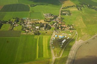
| Description | Oosterland in North-Holland, Netherlands |
| Date | |
| Source | Own work |
| Author | Jan Arkesteijn |
| Camera location | | View this and other nearby images on: OpenStreetMap |
|---|
Licensing
| This work has been released into the public domain by its author, I, Jan Arkesteijn. This applies worldwide. In some countries this may not be legally possible; if so: I, Jan Arkesteijn grants anyone the right to use this work for any purpose, without any conditions, unless such conditions are required by law. |
File history
Click on a date/time to view the file as it appeared at that time.
| Date/Time | Thumbnail | Dimensions | User | Comment | |
|---|---|---|---|---|---|
| current | 13:54, 23 July 2007 | | 1,200 × 800 (703 KB) | Jan Arkesteijn | {{Information |Description=Oosterland in North-Holland, Netherlands |Source=self-made |Date=21-7-2007 |Author= Jan Arkesteijn }} Category:Wieringen |
File usage
The following page uses this file:
Global file usage
The following other wikis use this file:
- Usage on ar.wikipedia.org
- Usage on arz.wikipedia.org
- Usage on ca.wikipedia.org
- Usage on de.wikipedia.org
- Usage on en.wikipedia.org
- Usage on eo.wikipedia.org
- Usage on eu.wikipedia.org
- Usage on fa.wikipedia.org
- Usage on fi.wikipedia.org
- Usage on fr.wikipedia.org
- Usage on fy.wikipedia.org
- Usage on ga.wikipedia.org
- Usage on it.wikipedia.org
- Usage on nl.wikipedia.org
- Usage on pt.wikipedia.org
- Usage on ro.wikipedia.org
- Usage on ru.wikipedia.org
- Usage on sv.wikipedia.org
- Usage on uk.wikipedia.org
- Usage on vi.wikipedia.org
- Usage on www.wikidata.org
- Usage on zh-min-nan.wikipedia.org
- Usage on zh.wikipedia.org