File:Sils-Segl Maria and Sils-Segl Baselgia.jpg

Size of this preview: 800 × 600 pixels. Other resolutions: 320 × 240 pixels | 640 × 480 pixels | 1,024 × 768 pixels | 1,280 × 960 pixels | 2,560 × 1,920 pixels | 5,184 × 3,888 pixels.
Original file (5,184 × 3,888 pixels, file size: 9.44 MB, MIME type: image/jpeg)
| This is a file from the Wikimedia Commons. Information from its description page there is shown below. Commons is a freely licensed media file repository. You can help. |
Summary
| Description |
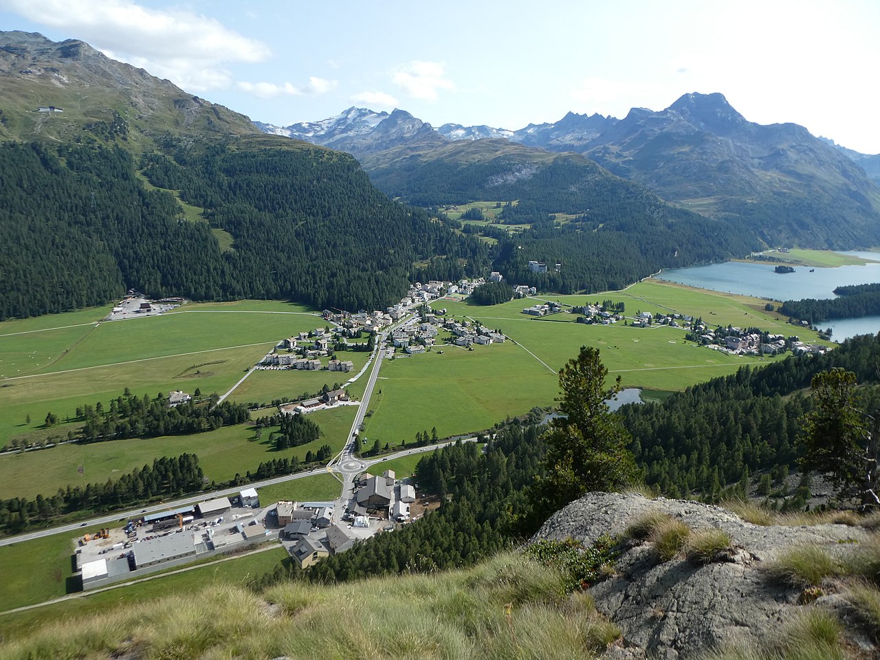
English: Sils/Segl Maria and Sils/Segl Baselgia, picture taken from the hiking path to Lej da la Tscheppa (Sils im Engadin/Segl, Grison, Switzerland)
Deutsch: Sils Maria und Sils Baselgia, aufgenommen vom Wanderweg zum Lej da la Tscheppa (Sils im Engadin/Segl, Graubünden, Schweiz)
Rumantsch: Segl Maria e Segl Baselgia, piglia se davent dalla senda tigl Lej da la Tscheppa (Sils im Engadin/Segl, Grischun, Svizra)
Italiano: Sils Maria e Sils Baselgia, fotografato dal sentiero Lej da la Tscheppa (Sils im Engadin/Segl, Grigioni, Svizzera) |
|
| Date | ||
| Source | Own work | |
| Author | Capricorn4049 | |
| Permission (Reusing this file) |
|
| Camera location | | View this and other nearby images on: OpenStreetMap |
|---|
| Object location | | View this and other nearby images on: OpenStreetMap |
|---|
Licensing
This file is licensed under the Creative Commons Attribution-Share Alike 4.0 International license.
- You are free:
- to share – to copy, distribute and transmit the work
- to remix – to adapt the work
- Under the following conditions:
- attribution – You must give appropriate credit, provide a link to the license, and indicate if changes were made. You may do so in any reasonable manner, but not in any way that suggests the licensor endorses you or your use.
- share alike – If you remix, transform, or build upon the material, you must distribute your contributions under the same or compatible license as the original.
| Annotations | This image is annotated: View the annotations at Commons |
File history
Click on a date/time to view the file as it appeared at that time.
| Date/Time | Thumbnail | Dimensions | User | Comment | |
|---|---|---|---|---|---|
| current | 23:30, 22 August 2017 | | 5,184 × 3,888 (9.44 MB) | Capricorn4049 |
File usage
The following page uses this file:
Global file usage
The following other wikis use this file:
- Usage on als.wikipedia.org
- Usage on cs.wikipedia.org
- Usage on de.wikipedia.org
- Usage on en.wikipedia.org
- Usage on et.wikipedia.org
- Usage on fa.wikipedia.org
- Usage on it.wikipedia.org
- Usage on ko.wikipedia.org
- Usage on nl.wikipedia.org
- Usage on rm.wikipedia.org