File:Thuringia relief location map.jpg

Size of this preview: 764 × 600 pixels. Other resolutions: 306 × 240 pixels | 612 × 480 pixels | 979 × 768 pixels | 1,280 × 1,005 pixels | 1,492 × 1,171 pixels.
Original file (1,492 × 1,171 pixels, file size: 798 KB, MIME type: image/jpeg)
| This is a file from the Wikimedia Commons. Information from its description page there is shown below. Commons is a freely licensed media file repository. You can help. |
Summary
| Description |
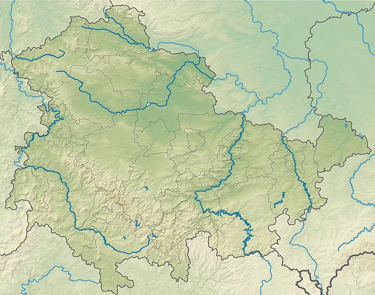
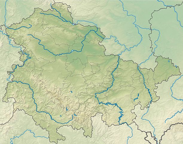
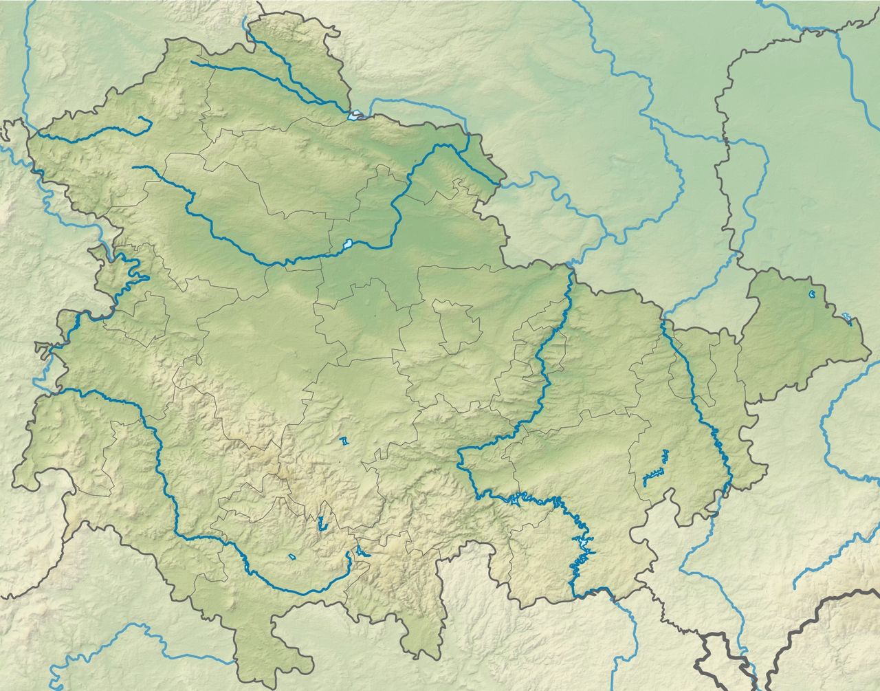
Deutsch: Physische Positionskarte Thüringen, Deutschland. Geographische Begrenzung der Karte:
English: Physical Location map Thuringia, Germany. Geographic limits of the map:
|
| Date | |
| Source |
Own work |
| Author | Grundkarte TUBS, Relief Alexrk2 |
| Other versions |
|


|
This map has been made or improved in the German Kartenwerkstatt (Map Lab). You can propose maps to improve as well.
|
Licensing
I, the copyright holder of this work, hereby publish it under the following license:
This file is licensed under the Creative Commons Attribution-Share Alike 3.0 Unported license.
- You are free:
- to share – to copy, distribute and transmit the work
- to remix – to adapt the work
- Under the following conditions:
- attribution – You must give appropriate credit, provide a link to the license, and indicate if changes were made. You may do so in any reasonable manner, but not in any way that suggests the licensor endorses you or your use.
- share alike – If you remix, transform, or build upon the material, you must distribute your contributions under the same or compatible license as the original.
File history
Click on a date/time to view the file as it appeared at that time.
| Date/Time | Thumbnail | Dimensions | User | Comment | |
|---|---|---|---|---|---|
| current | 19:49, 12 October 2009 | | 1,492 × 1,171 (798 KB) | Alexrk2 | == {{int:filedesc}} == {{Information |Description= {{de|Physische Positionskarte Thüringen, Deutschland. Geographische Begrenzung der Karte:}} {{en|Physical Location map Thuringia, Germany. Geographic limits of the |
File usage
The following 2 pages use this file:
Global file usage
The following other wikis use this file:
- Usage on ar.wikipedia.org
- Usage on ba.wikipedia.org
- Usage on be.wikipedia.org
- Usage on bg.wikipedia.org
- Ерфурт
- Ваймар
- Айзенах
- Илменау
- Гера
- Мюлхаузен
- Йена
- Гота
- Вайсензе
- Зьомерда
- Ордруф
- Арнщат
- Валтерсхаузен
- Рула
- Грайц
- Шлайц
- Оберхоф
- Майнинген
- Шаблон:ПК Германия Тюрингия
- Алтенбург
- Шлойзинген
- Хилдбургхаузен
- Нордхаузен
- Айзенберг (Тюрингия)
- Трефурт
- Шварцбург
- Зондерсхаузен
- Лойтенберг
- Рьомхилд
- Байхлинген
- Кранихфелд
- Рудолщат
- Бад Франкенхаузен
- Бад Лобенщайн
- Щатилм
- Фридрихсверт
- Кройцбург (Германия)
- Орламюнде
- Херинген
- Тона
- Бад Лангензалца
- Ебелебен
- Хелбедюндорф
- Фридрихрода
- Залфелд
- Нойщат ан дер Орла
View more global usage of this file.