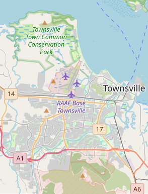
File:Townsville locator map.svg

Size of this PNG preview of this SVG file: 294 × 385 pixels. Other resolutions: 183 × 240 pixels | 366 × 480 pixels | 586 × 768 pixels | 782 × 1,024 pixels | 1,564 × 2,048 pixels.
Original file (SVG file, nominally 294 × 385 pixels, file size: 3.42 MB)
File history
Click on a date/time to view the file as it appeared at that time.
| Date/Time | Thumbnail | Dimensions | User | Comment | |
|---|---|---|---|---|---|
| current | 04:11, 12 April 2023 |  | 294 × 385 (3.42 MB) | Thiscouldbeauser | Uploaded a work by Open Street Map contributors from https://www.openstreetmap.org/#map=11/-19.3037/146.7928 with UploadWizard |
File usage
The following 2 pages use this file:
Global file usage
The following other wikis use this file:
- Usage on en.wikipedia.org
- Annandale, Queensland
- Mount Louisa, Queensland
- Douglas, Queensland
- Vincent, Queensland
- Stuart, Queensland
- Kirwan, Queensland
- Belgian Gardens, Queensland
- Oonoonba, Queensland
- Rowes Bay, Queensland
- Mundingburra, Queensland
- North Ward, Queensland
- Pallarenda, Queensland
- Cluden, Queensland
- Mount St John, Queensland
- Currajong, Queensland
- Rosslea, Queensland
- Cosgrove, Queensland
- Bohle, Queensland
- Module:Location map/data/Australia Townsville
- Module:Location map/data/Australia Townsville/doc
- Usage on si.wikipedia.org
