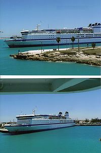
Freeport, Bahamas
Freeport is a city, district and free trade zone on the island of Grand Bahama. It is in North-west Bahamas. In 1955, Wallace Groves, a Virginian financier, was given 50,000 acres (or 202 km2) of pineyard with swamp and scrubland areas by the Bahamian government. They were asked to develop the area economically. Freeport has grown and is now the second most populous city in the Bahamas. The main airport in Freeport is the Grand Bahama International Airport. The Grand Bahama Port Authority (GBPA) runs the free trade zone, under the Hawksbill Creek Agreement signed in August 1955. There, the Bahamian Government agreed that businesses in the Freeport area will pay no taxes before 2054. The area of the land grants has been increased to 138,000 acres (or 526 km2).[1]
City of Freeport | |
|---|---|
 | |
| Nickname(s): The Industrial Capital The Second City | |
| Motto: Love is everything | |
| Coordinates: 26°31′42.5″N 78°41′47.7″W / 26.528472°N 78.696583°W | |
| Country | Bahamas |
| Island | Grand Bahama |
| District | Freeport |
| Established | 1955 |
| Government | |
| • Type | District Council |
| • Body | City of Freeport District Council |
| • Chief Councillor | Antia Doherty |
| • Deputy Chief Councillor | April Crother-Gow |
| Area | |
| • City | 558 km2 (215 sq mi) |
| Elevation | 10 m (30 ft) |
| Population (2000) | |
| • City | 26,910 |
| • Density | 48/km2 (125/sq mi) |
| • Metro | 55,500 |
| Time zone | UTC-5 (Eastern Time Zone) |
| Area code | 242 |
| IATA airport code | FPO |
| ICAO airport code | MYGF |
| Website | http://gbpa.com/home/ |
References
change- ↑ "Freeport Grand Bahama". Government of the Bahamas.