Lidar
remote detection instrumentation
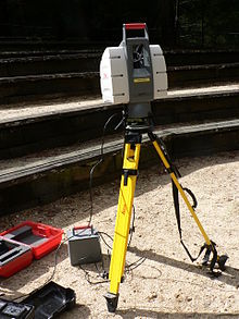
Lidar is a method for measuring distances by using a laser on a target and measuring its reflection with a sensor.

History
changeAfter the invention of laser, first tool similar to a lidar was made in 1961 at Hughes Aircraft Company.[1] It was first intended to track satellites.[2] It was originally called "Colidar", acronym for "Coherent Light Detecting And Ranging".[3]
One of first usages of lidar were in meteorology. National Center for Atmospheric Research used it to measure clouds and pollution.[4]
References
change- ↑ "New Radar System". Odessa American. 28 Feb 1961.
- ↑ "COLIDAR". Journal of the American Society for Naval Engineers. 73 (4): 681–684. 2009-03-18. doi:10.1111/j.1559-3584.1961.tb03324.x.
- ↑ "COLIDAR - Coherent Light Detection and Ranging in Undefined by AcronymsAndSlang.com". acronymsandslang.com. Retrieved 2022-05-01.
- ↑ Goyer, G. G.; R. Watson (September 1963). "The Laser and its Application to Meteorology". Bulletin of the American Meteorological Society. 44 (9): 564–575 [568]. Bibcode:1963BAMS...44..564G. doi:10.1175/1520-0477-44.9.564.