Manatuto Municipality
municipality in East Timor
Manatuto is one of the municipalities (formerly districts) of East Timor. The capital of the municipality is also named Manatuto.
Manatuto
Manatutu | |
|---|---|
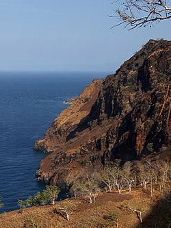
 Cliffs at Manatuto | |
 Map of East Timor highlighting Manatuto Municipality | |
| Coordinates: 8°42′S 125°55′E / 8.700°S 125.917°E | |
| Country | |
| Capital | Manatuto |
| Area | |
| • Total | 1,783.34 km2 (688.55 sq mi) |
| Population (2015) | |
| • Total | 46,619 |
| • Density | 26/km2 (68/sq mi) |
| ISO 3166 code | TL-MT |
To the north is the Strait of Wetar, to the south is the Timor Sea.
Administrative posts
changeThe municipality's administrative posts (formerly sub-districts) are:[1][2]
- Barique-Natarbora (pop. 5,438)
- Laclo (pop. 7,756)
- Laclubar (pop. 12,050)
- Laleia (pop. 3,689)
- Manatuto (pop. 14,392)
- Soibada (pop. 3,294)
The administrative posts are divided into 31 sucos ("villages") in total.
References
change- ↑ "Manatuto Suco Reports". Timor-Leste Ministry of Finance.
- ↑ Gunn, Geoffrey C (2011). Historical Dictionary of East Timor. Lanham, Maryland: Scarecrow Press. p. 124. ISBN 9780810867543.
